Alone in Utah:
A personal Narrative of
My First Solo Adventure
I love to travel. As I matured and my interests and hobbies were refined, I experienced fresh wonders and pondered deeper thoughts with each new journey. Learning about a location's history and culture and more importantly for me, allowing a new landscape to wash over me ballasts my restless mind. All my travels have been treasured, shared experiences with family, friends, or my girlfriend, but I have daydreamed about what it would be like to explore the world alone. How would that change the experience? Would I be scared? Would I be organized enough? Would I be too lonely to enjoy the landscapes? All of these anxieties permeated through my brain, interrupting the reveries of beautiful sunrises and starry night skies, as I wrestled with and prepared for this trip to Utah, my very first completely alone. Ultimately the excitement for a new challenge exploded like lava from a dormant volcano above the doubts, and I knew it was something worth trying for my personal growth.
On the surface, the goal of this trip was to explore the stunning National Parks in Utah. This was my initial impulse, the inception of the idea. By traveling alone, I had the unique opportunity to plan an itinerary focused solely on photography. I would be able to prioritize light and weather conditions to dictate where and when to move. I would be nudged awake by the cool morning air and the calling of birds to capture fantastic sunrises over settings chosen with care. I would then ensure the day ended at prime locations to capture the golden orb’s descent into darkness. Then I would scamper off to the best places to aim my cameras at the night sky to pay my respects to the stars and the milky way. Relying more on daytime rests than nocturnal slumber. Cooking meals out of the back of the car rather than a tourist-packed restaurant or within the confines of a hotel room. I could accomplish it all without inconveniencing a travel companion, or, in turn, having to bend my plans to please another.
The trip would afford me all this, my plan to arrive in Utah, head to Bonneville Salt Flats; trek down to Capitol Reef National Park and traverse the Caineville Wilderness; marvel at Goblin Valley and Dead Horse State Parks; wander through Canyonlands National Park and see the Corona Arch; and finally, venture to Warner Lake and Arches National Park.
But quietly, I pondered how I would handle the solitude and lack of support, moral or direct, from the folks with whom I normally traveled. I did not discuss with my support network this anxiety stirring within, for it was a question I had resolved to explore on my own, something I was still mulling over as I arrived at Reagan International Airport in Washington DC on September 16, 2023. As I boarded the the plane, I felt like I was finally breaking out of my childhood shell completely. A sheltered and cared for child who has never lived more than 30 minutes from my childhood home and never far away from friends and family, I wanted to know how my brain would handle the shock of it all? As the plane jetted into the air, I knew I was about to find out!
Part 1: Bonneville Salt Flats & Uinta National Forest
How could things change so fast? … 10 minutes ago my mindset was in the clouds, everything was working out perfectly. My trip was beginning on the right foot…And now I am stuck! No really, the tires are spinning, and the engine is revving into the red, but my 5,000-pound Ram 1500 4X4 Hemi rental is resolutely still. I am sitting on the Bonneville Salt Flat 90 miles from Salt Lake City under a pitch black Utah Sky, approximately 11 pm. Even with the brights on full blast, I can barely see 25 feet in front of me. Just a minute ago I was on the vast expanse of hard-packed salt bed that covers the land to the west of the Great Salt Lake. This salt pan is a remnant of an ancient lake, thought to have been around the size of Lake Michigan, covering much of the northwestern part of the state. Unfortunately, the area is not all dry and salty, as I learned when I strayed too far from the hard pack and my tires sunk into sticky clay. Every time I rev the engine, desperate to head towards the lights of the highway before me, my only reward is a splattering of mud and the sound of screaming tires. I just need to calm down, breathe, and think, I got a heavy-duty off-road truck for this reason, so relax and get yourself out of it.
Twelve hours earlier, I touched down in Salt Lake City brimming with expectation and confidence. My long months of planning were finally put to the test, and as we all know, even the best of plans can fly off a salt bed into the soft clay. Not only was I stuck in a morass, but I had already managed to break the solitude of my solo plan!
A few days before embarking I noticed on social media that my best friend from high school, Zach, was in Utah on vacation. I reached out to him to tell him I’d be there in just a matter of days and learned we were going to overlap in Salt Lake City for a few hours the day I arrived. It would be stupid not to meet him to catch up. To make things even more convenient, he had not visited the salt flats yet, so was eager to team up with me that night. Before rushing to my first adventure, I had to collect supplies for the rest of my trip. Camping gear and MRE meals from REI, more food from Smith’s Marketplace, and a portable solar generator. In order to complete such an ambitious photography trip without utilizing any modern accommodations with access to electricity, I needed to get creative. So before the trip I found a website, www.sharegrid.com, which facilitates peer to peer photography and cinematography gear rental. I was lucky enough to find someone in the city renting out their solar generator and so my last stop was to find them and secure the last vital piece of my master plan. Errands out of the way, I stopped for a quick lunch at In-N-Out Burger (superdeluxe with the special sauce, fries and a coke!) then picked up Zach and headed straight for the salt flats. I had a lot of anticipation built up from all the months of waiting to be here and was bursting to be standing in the middle of the vast white salt landscape taking it all in.
The concept of a “salt flat” or “salt pan” has always fascinated me since I first read about the existence of salt pans in Bolivia. They form when salt and other minerals from ancient lakes or collections of water slowly evaporate due to the inability of the ground to dissipate the water. This evaporation process creates deposits of all the minerals from the water, which settle down to lie for perpetuity. These flat expanses are usually features of desert climates and provide a unique canvas for extremely harsh conditions and subtle beauty at the same time. When it rains, the flats gloss over like giant mirrors for the stars, reflecting their heavenly glow in an amazing display.
When I discovered that there was a salt flat in Utah, I knew I needed to visit, even though it was not on the route for the rest of my trip. Besides my fascination with these natural wonders, they are usually very remote and therefore low-light pollution areas, perfect for stargazing. As an astrophotographer from the East Coast, any time I can find a picturesque dark location I will sacrifice sleep and sanity to try to get dark skies, and this spot did not disappoint me!
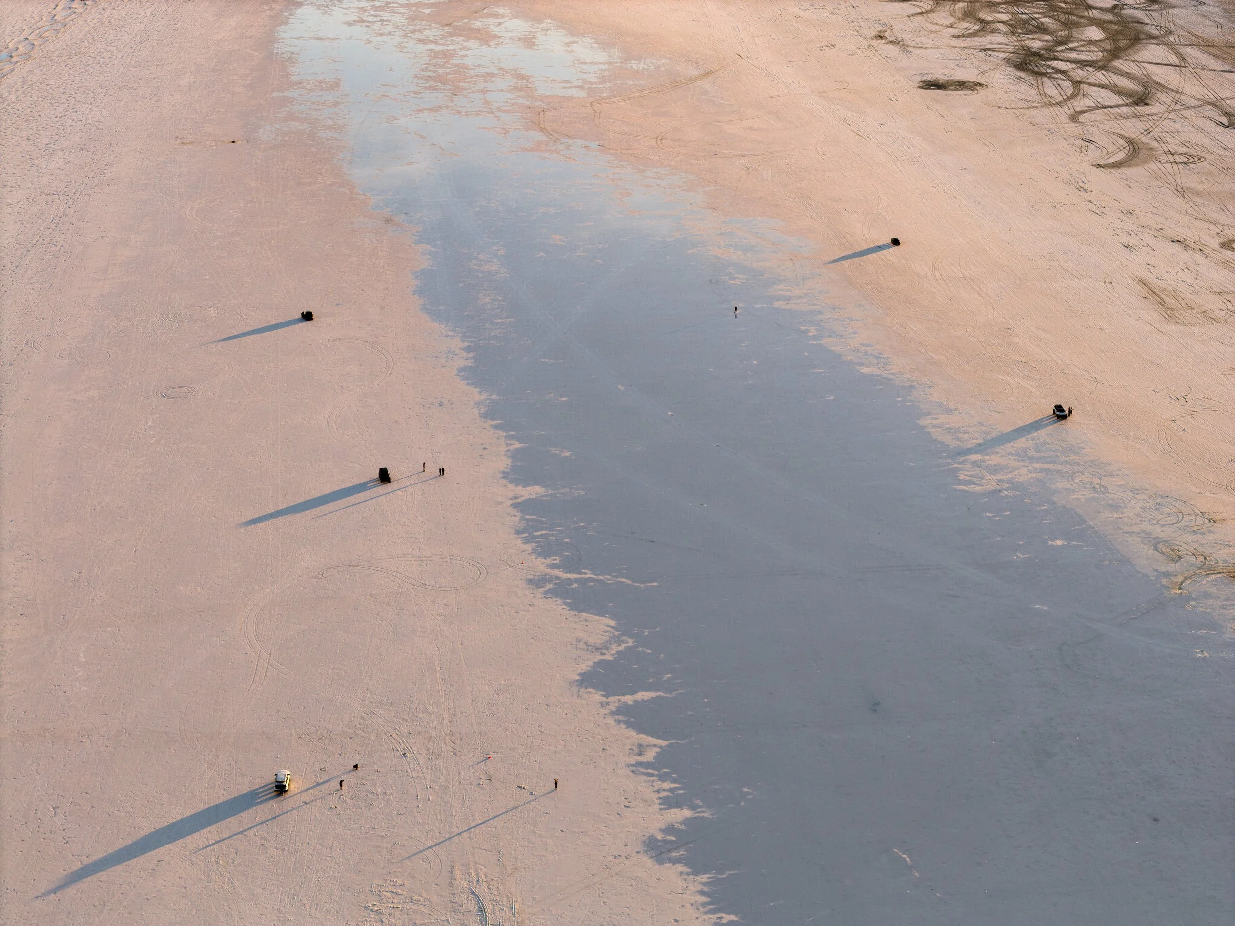
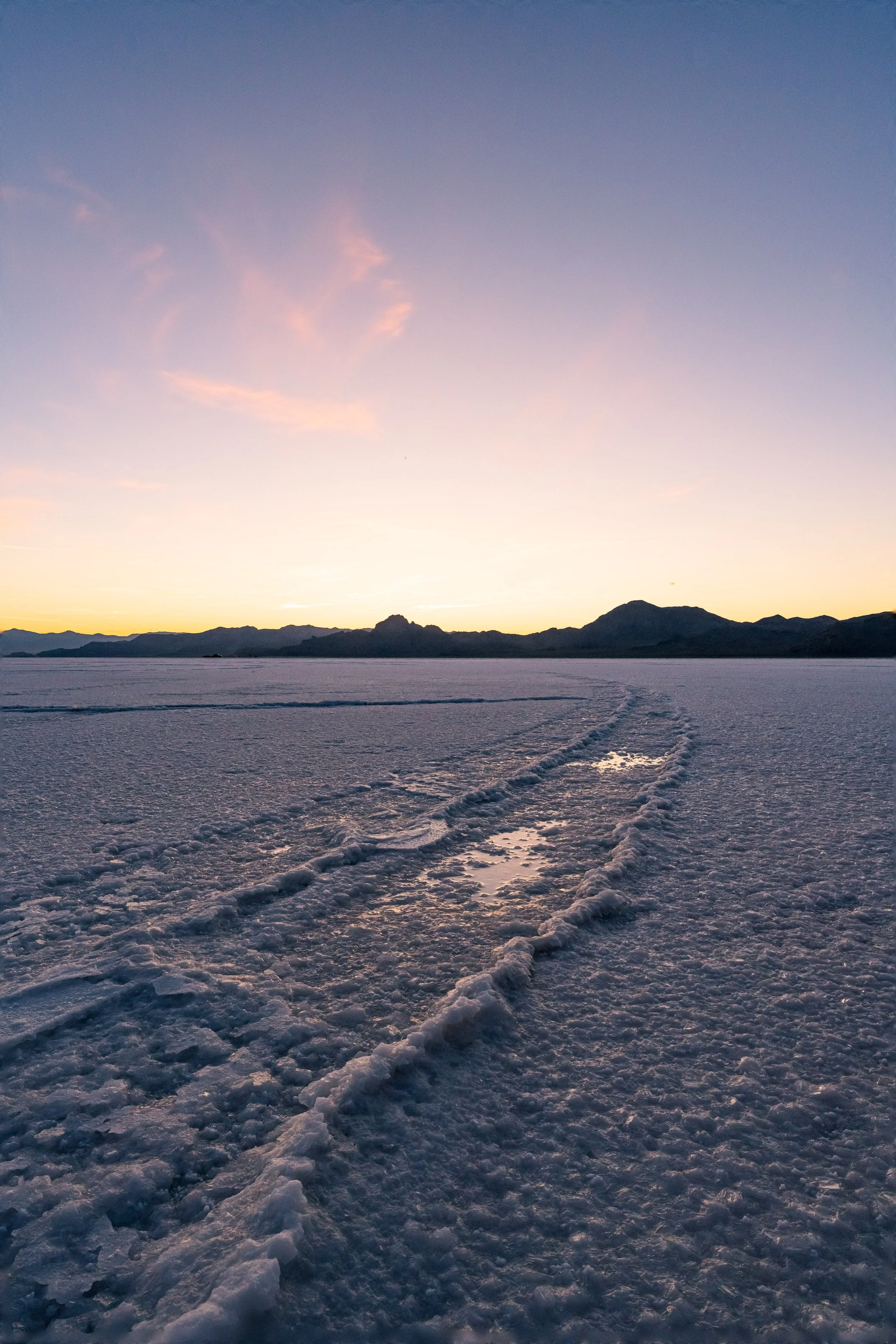
From the moment my wheels touched the salt the air was filled with wonder and every direction was awe inspiring. The salt pan itself is a fairly monotone landscape, the white surface of minerals shines brightly in the mid-evening sun, brown inhospitable foothills of the salt on all sides give it a giant basin feeling. Yet with my drone soaring above, it became a whole new world. Cars tearing across the flats with no apparent destination. Rays of light shining over the hills, washing the surface in a soft yellow glow. Mirror-still puddles of days-old rain glimmering in the center of the flat, a reminder that long ago this used to be a wet and vibrant part of the world. We delighted in driving the truck around with no rules, no stop light, no yellow lines, no police. When the sun sunk low on the horizon we found a place to sit and watch its final descent, anticipating the night sky. By 9 pm, the last remnants of pink and orange dusk was smothered by the black of night, and high above the salty brine and puddled water, the Milky Way shone in its full magnificence, dominating the star-dotted sky. I have taken many journeys to many climates and unique landscapes to see the stars but the experience has yet to grow old. Zach, too, was struck with awe, and exhilarated, we could not help but exclaim our amazement repeatedly through the night. Quietly, I could not help but feel the pride in perfectly made plans, and in my flexibility to accommodate the unplanned addition of my friend!.
But then there was mud! As I sat quietly freaking out because I had just beached my car on day one, I had to remind myself that this is why I took this trip. Not to say I wanted to get stuck or try to put myself in dangerous or precarious situations, but you cannot completely avoid the dangers of earth and still have adventures. At home, insulated by the comfort of our well ordered society it is easy to hide from basic problems and forget that small struggles can become major issues if not handled properly in the wild. Quickly, my positive thoughts allowed me to overcome the panic. I looked to the sky and realized that I was exactly where I wanted to be and that every difficulty has a solution if you can think through it. After a calm assessment of my plight, I realized I was not as trapped as initially feared. The mud was not so deep, nor was the truck so incapable that it could not extricate itself. I switched the car into low 4X4 mode and by slowly layering on the throttle, coaxed the tires through the mud. Momentum slowly built up to direct the truck onto the hard-packed salt, then the asphalt that led off the ancient lake bed. With the Milky Way smiling upon us overhead, we headed back to Salt Lake City.
The trip was now truly underway. I was hoping for complete solitude when I set out, but having a friend with me to experience the salt flats turned out to be a pleasant bonus. I was quickly learning that flexibility could embellish an adventure more than a stubborn rigidity. Moments of unexpected randomness only enhance the freedom and liveliness of an experience meant to challenge. While I really wanted to stick to my planned short sleep in the truck on or near the salt flat, Zach offered the airbnb couch to crash on, and who am I to turn down the generosity of a good friend?
By the time we got back to Salt Lake, it was already 2 am and I had an early morning ahead of me because, although plans changed, my goals had not. I wanted to rob the sun of its power to trigger my body clock, and be somewhere new to capture more beautiful scenes, determined to take advantage of every opportunity!
Bonneville Salt Flats (More information on these salt flats: https://www.utah.com/destinations/natural-areas/bonneville-salt-flats/ )
I was jolted awake by the high-pitched noise of my phone, the whine of the inescapable technology aiding my break from natural cycles, awake at the obscene hour of 4:30 a.m. I snuck out of Zach’s apartment to my mud-caked truck, ready to flee from the city for secluded and more serene environs. Before moving away from the sleepy city I had two pressing issues to address. First was the matter of my disorganized supplies, strewn haphazardly in the truck’s back seat the moment I took possession of it. This state of disorganization could not continue. If there is anything that I have learned from my other road trips, it is the paramount importance of a well organized workstation, or in this case, bags of supplies and equipment. Allowing the desultory condition of the rear seat to persist would drive me nuts and waste precious photography time searching, or worse, the misplacement of valuable tools. My absolute need for order tempered my burning desire to drive straight away as fast as possible. Thirty minutes later, all of my gear, maps and documents, tripods, and lenses were in order. And I had figured out where my portable generator would live in the truck so I could easily replenish the batteries powering my manifold photographic devices.
With the car now in a state of tenuous zen, I could turn my attention to the second pressing issue of the morning: My original plan was to start the day at the salt flat and take pictures of the sunrise on the way back to Salt Lake City, but now that I was already in Salt Lake. I needed to find a new location to stalk the dawning of the day.
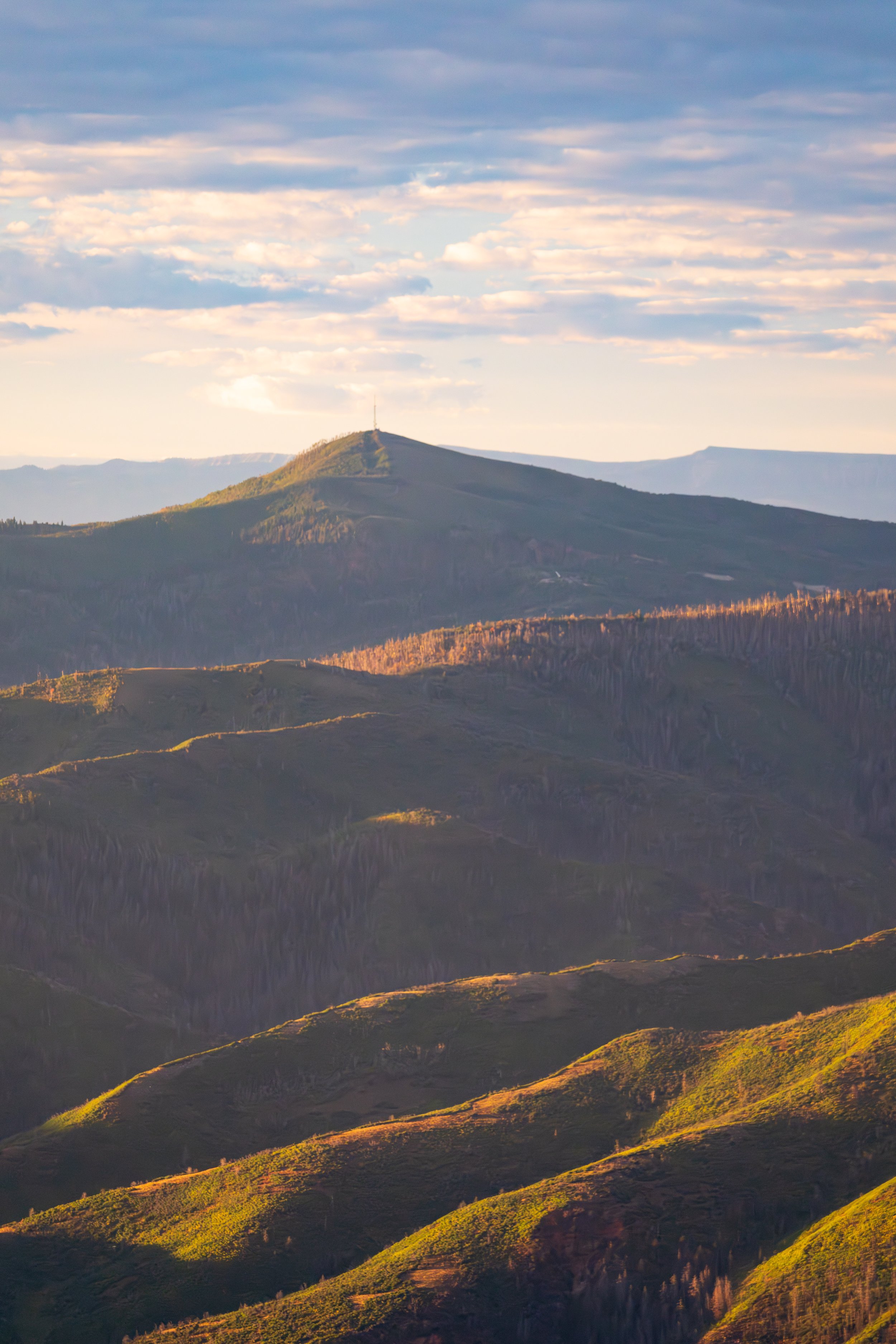
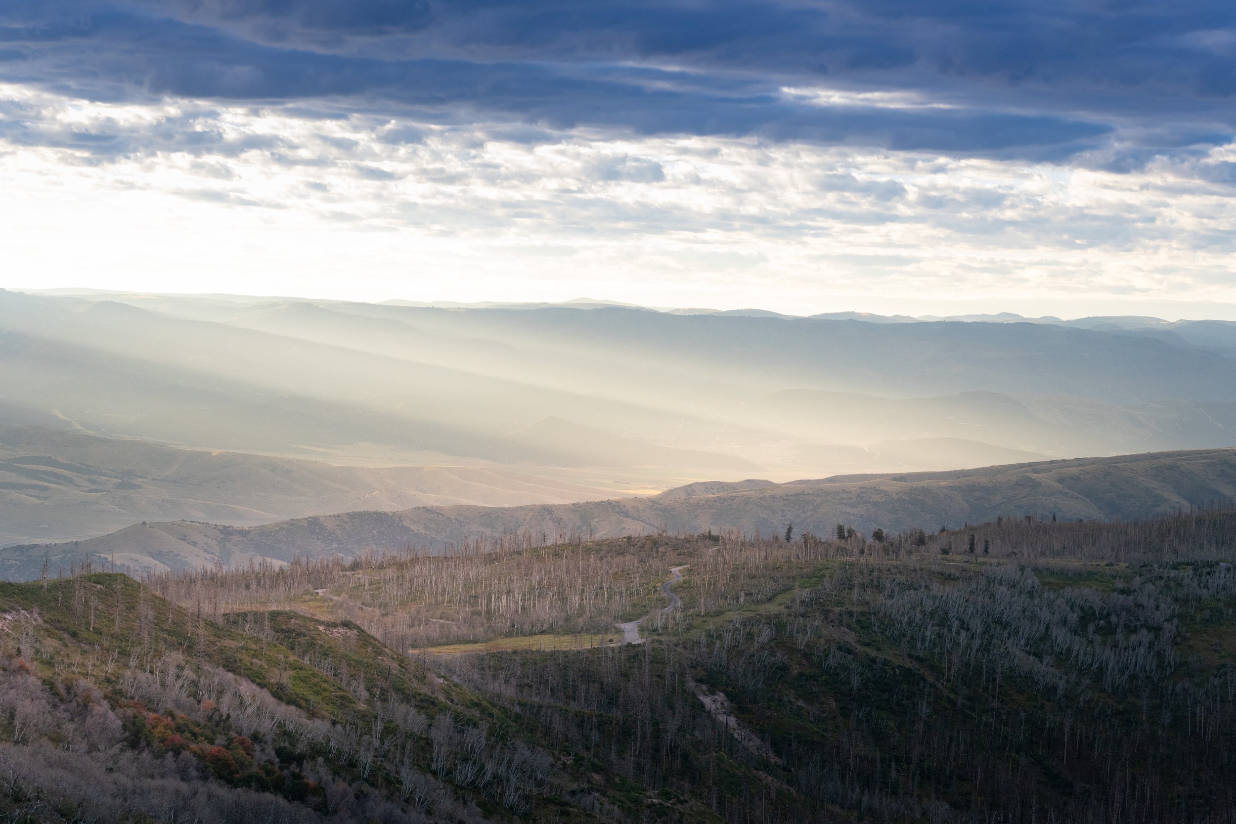
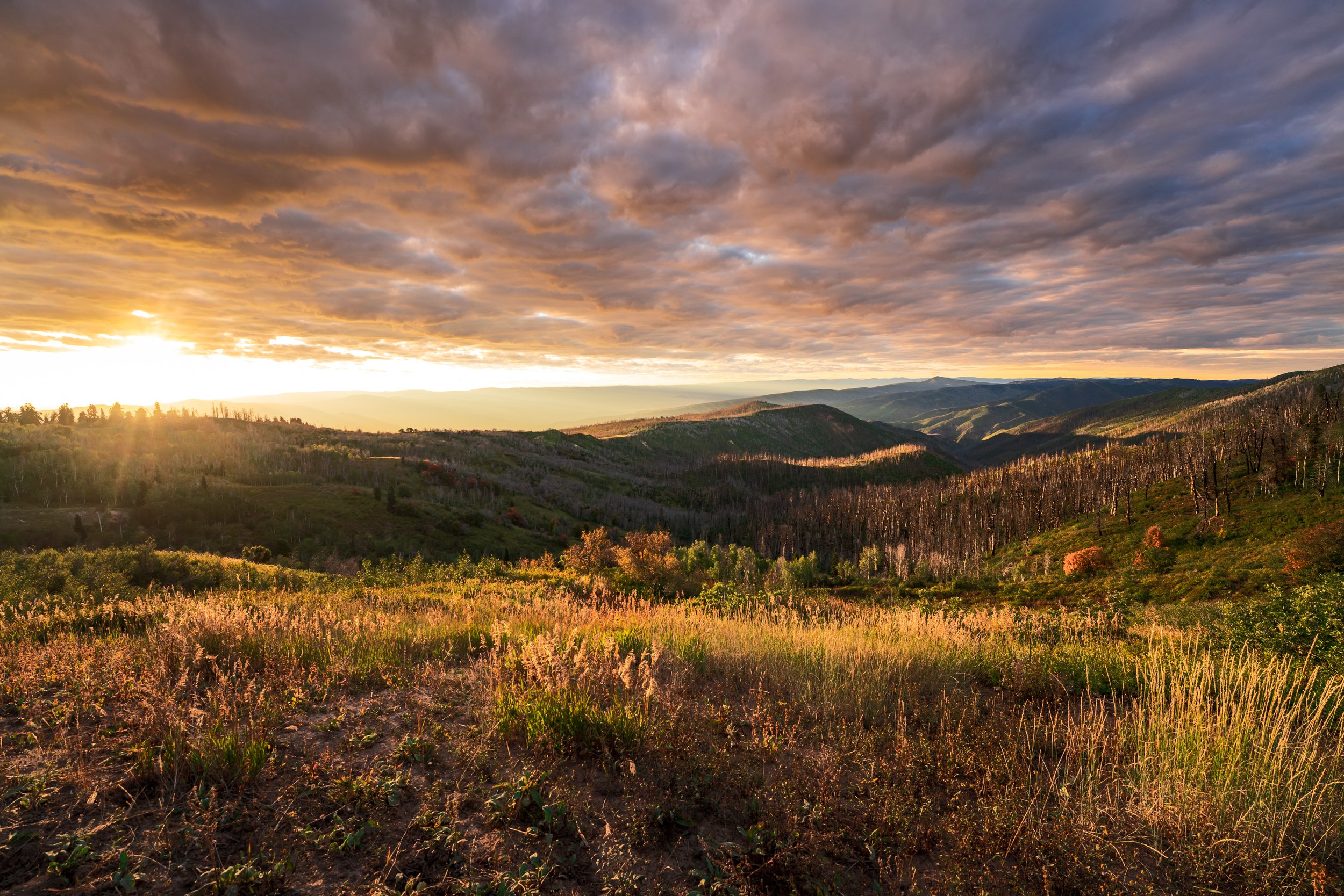
A lot of planning goes into finding locations that I think yield photogenic conditions for a specific time of day, and therefore, I was in quite a scramble to find a suitable replacement. I was not 100% convinced of my original location, so I did not fret much over this change. Arriving I couldn’t take my eyes off of the mountain range east of the city which parallels the North-South Run of the city limits. A quick browse of google maps yielded a few suitable overlooks, so I chose one relatively close to RT 15 South, the road I would travel to Capitol Reef National Park later that day. Skirting up against the legal limits of hasty travel, I recached the overlook about 20 minutes before pre-dawn golden hour. It was immediately clear that this spot, arbitrarily chosen with little research would not work as it was both not high enough into the mountains and it was too thickly wooded to serve as an actual overlook of anything! Distressed, with fresh waves of anxiety creeping over me, the good fortune for the rest of the day felt in jeopardy. If I was going to be outsmarted so early, what other puzzles would stand in my way later? Undeterred, I searched for an alternative, no time for proper research or sufficient cell service. The road took me higher into the mountains. I passed a sign signaling I had entered the Uinta-Wasatch-Cache National Forest, and my fortunes slowly started to brighten with each hairpin turn in perfect unison with the lightening sky. This forest, known for stunning ski resorts like Park City, provides a dazzling backdrop in summer as I was about to discover. As I summitted the peak before me, I glimpsed vast valleys through the thinning trees to either side of the climbing roadway. I was getting restless because dawn was knocking and the sky would show her stupendous colors any minute. Through the haze of the unknown rose a sign...for “Beaver Dam Overlook”. I steered to it, hoping for the best. As I pulled around the small parking loop, I was met with a truly breathtaking view. The arms of the mountain stretch eastwards covered with beautiful Douglas firs and Engelmann pine trees. The mountain flanks cut deep narrow valleys throughout the range and across the valley more peaks jut out with distant roads and watch towers highlighting the skyline. It was 6:45 am, 10 minutes before golden hour. I rushed to set up a timelapse that would capture the sun rays rising above the mountains.
As I sat there waking up and drinking it all in, I was overwhelmed by an intense wave of joy and excitement, I finally felt like the trip had started. These moments make me love traveling and photography, I sat and listened to the birds chirping, the wind rustling through the trees, and the absence of human sound and thought about creative and interesting ways of capturing the beautiful landscape around me. Soon the ridged and puffy clouds were pumpkin orange and rolling across the sky with the dappling rays creeping from the east as the sun rose higher and higher. Once settled into the groove of my craft enough to take a quick breath, my body’s intense hunger betrayed the mood, and making breakfast became utterly necessary if I were to maintain my creative fervor. I set up my camping stove and brand new AeroPress coffee maker and boiled water for oatmeal and coffee. One other explorer joined me on the ridge to experience this site, both of us intensely focused on our own experiences, respectfully maintaining the quiet so necessary to fully appreciate the scene. I lingered at the overlook for over an hour until the golden sunlight intensified into a mid-morning glare, and it was time to get moving. As I cut my way through the rest of the winding forest roads on the descent back to Route 15, I had that “top of the world” feeling, and was ready to conquer a full week of early mornings, late nights, and as much photography as I could stay awake for!
Part 2: Capitol Reef National Park & Caineville Wilderness
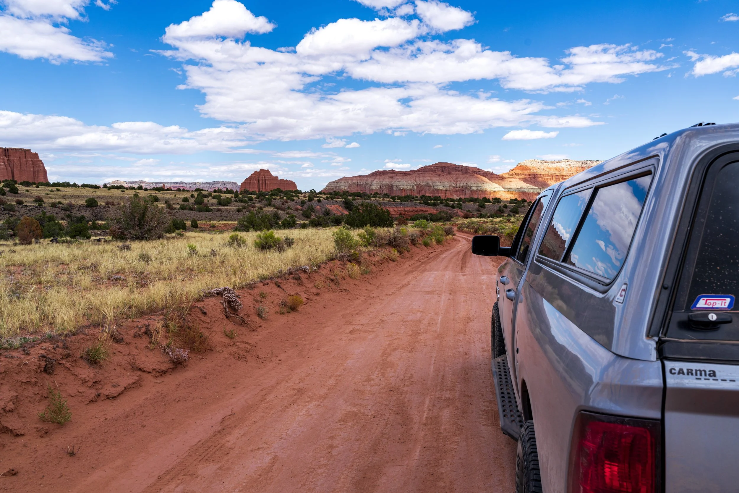
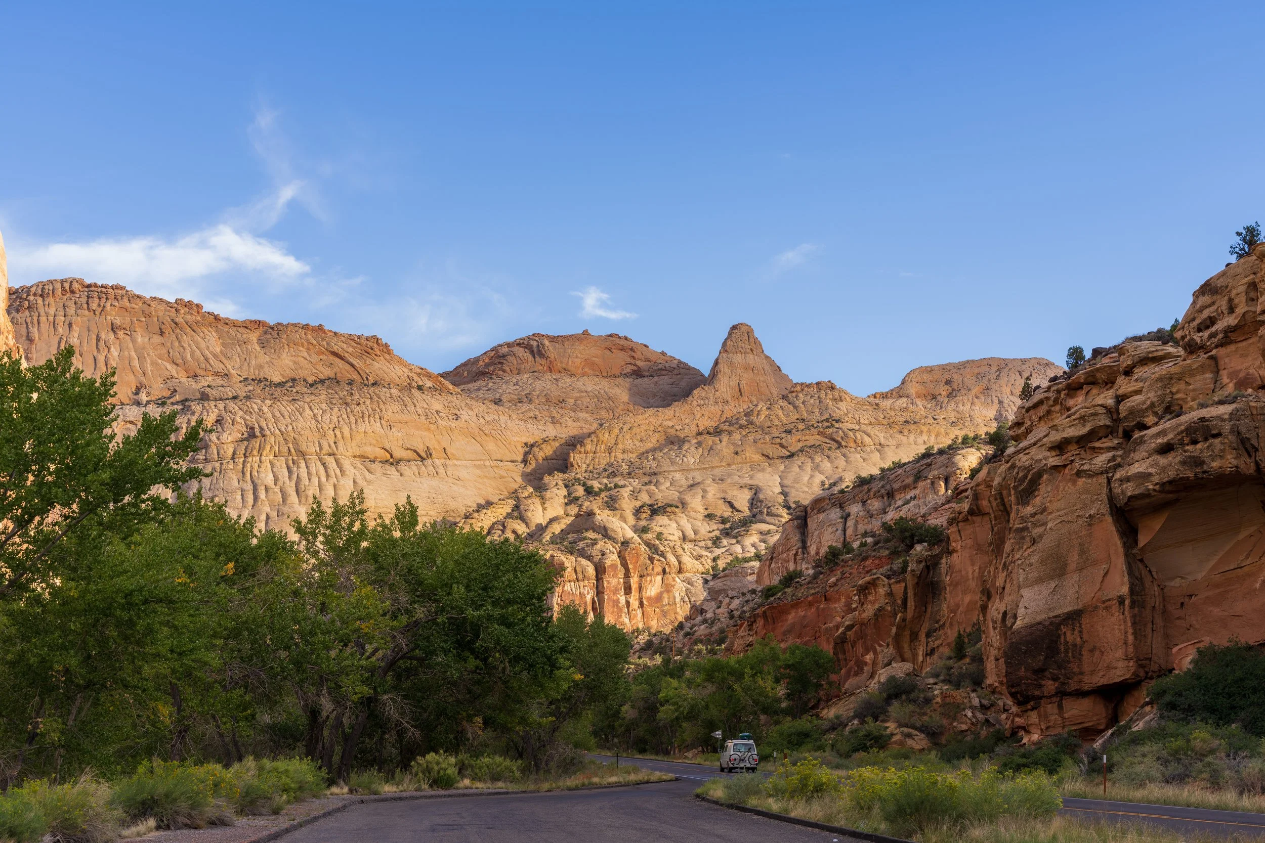
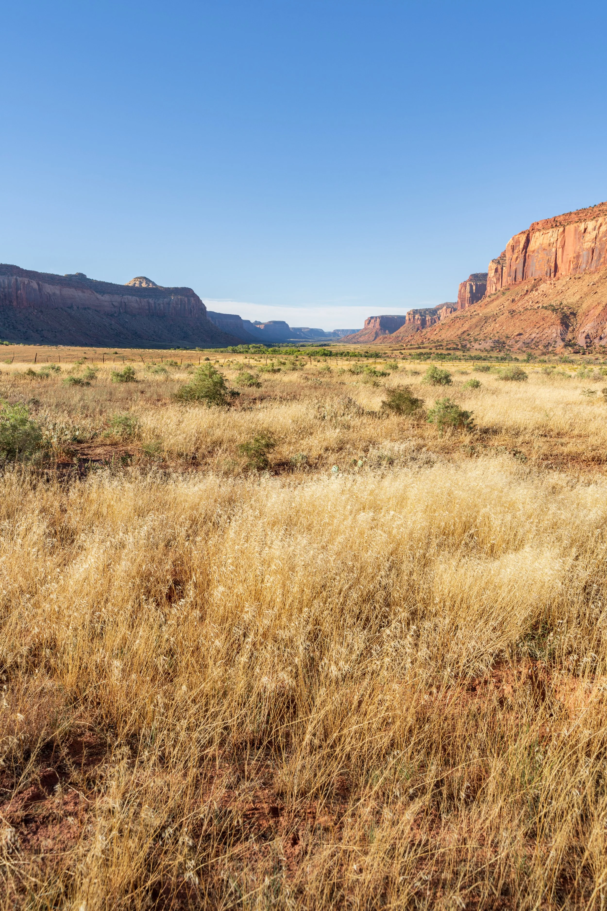
The next stage of my trip guided me away from civilization...finally! The lush and green forested mountains fell away slowly into golden plains of tall grass and weathering fields of late-harvest crops as the road wended south from Salt Lake. To reach the wilderness of Capitol Reef I first needed to stop at an adjacent town, Loa, for a final refill of gas and to deflate my tires to better manage off-roading. When I turned off the last paved road after Loa, I began rising through the densely forested western face of the mountains guarding the low deserts beyond. My path took me to the summit of Hens Hole Peak at the northern border of Capitol Reef National Park. As I crested the mountain, I observed a vast canyon lengthening out in front of me like a never-ending abyss of rocky cliffs and orange, sandy flats. The northern portion of the park is not frequently traveled due to the deliberate lack of paved roads to guide casual tourists through these wild parts. Looking down into the bleached desert canyons that form much of southeast Utah, I marveled at how quickly the landscape changes, the mountains and canyon walls acting as barriers blocking the ingress of rain and life.
The descent from the mountain was nothing short of treacherous; the small dirt road spooled down the slope, often littered with large rocks. The steep grade added to the intensity, and driving was more like controlled braking, my foot pressing the brake pedal flat to the floor to maintain a modicum of safe speed. To add to the madness, when careening around sharp corners, the truck seemed to startlethe only residents of this desolate slope, cattle, doing nothing more than enjoying their midday meals, causing them to dash across the road directly in front of my trajectory. If not for careful piloting, the truck and myself certainly would have wrecked!
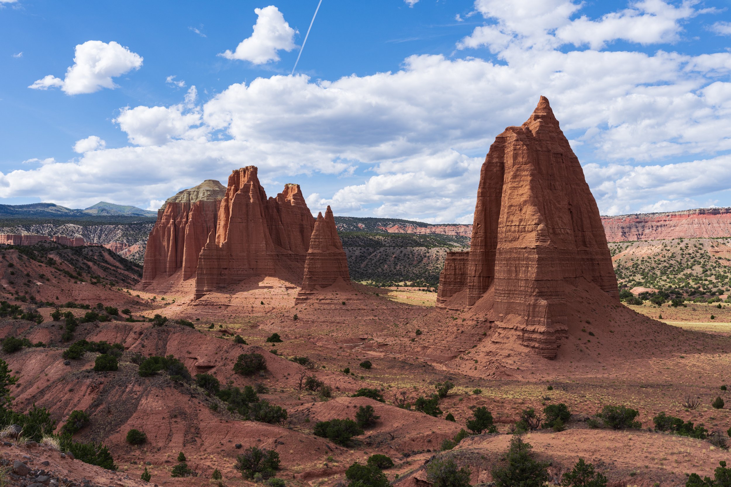
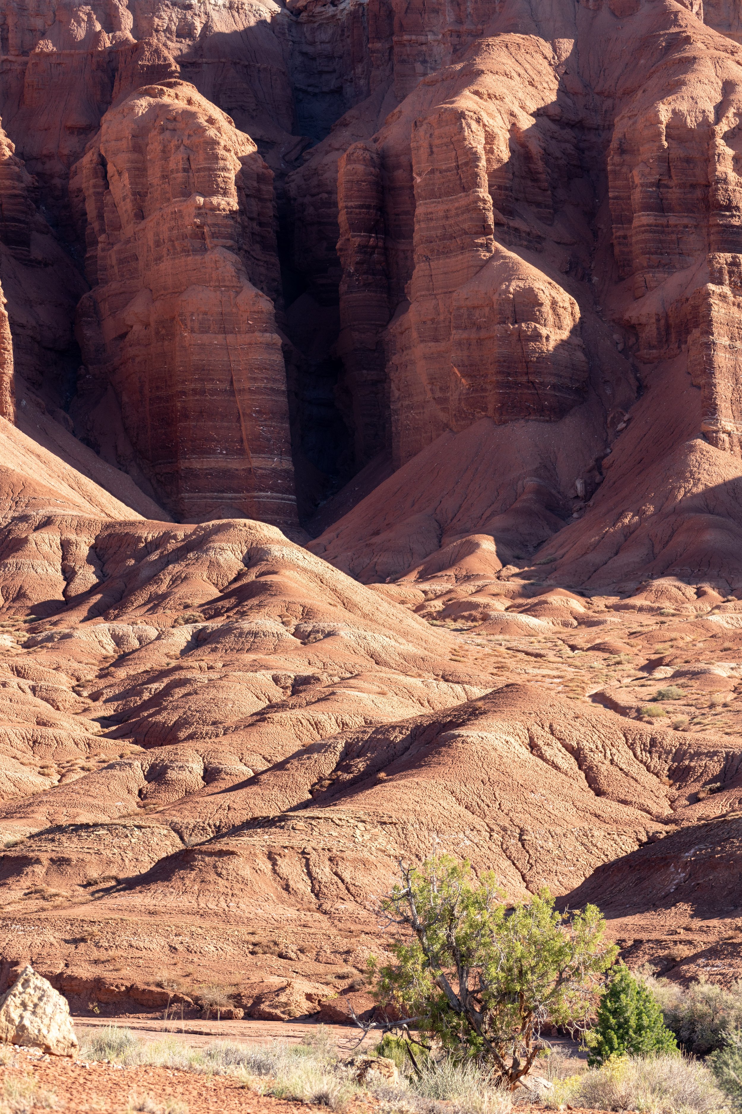
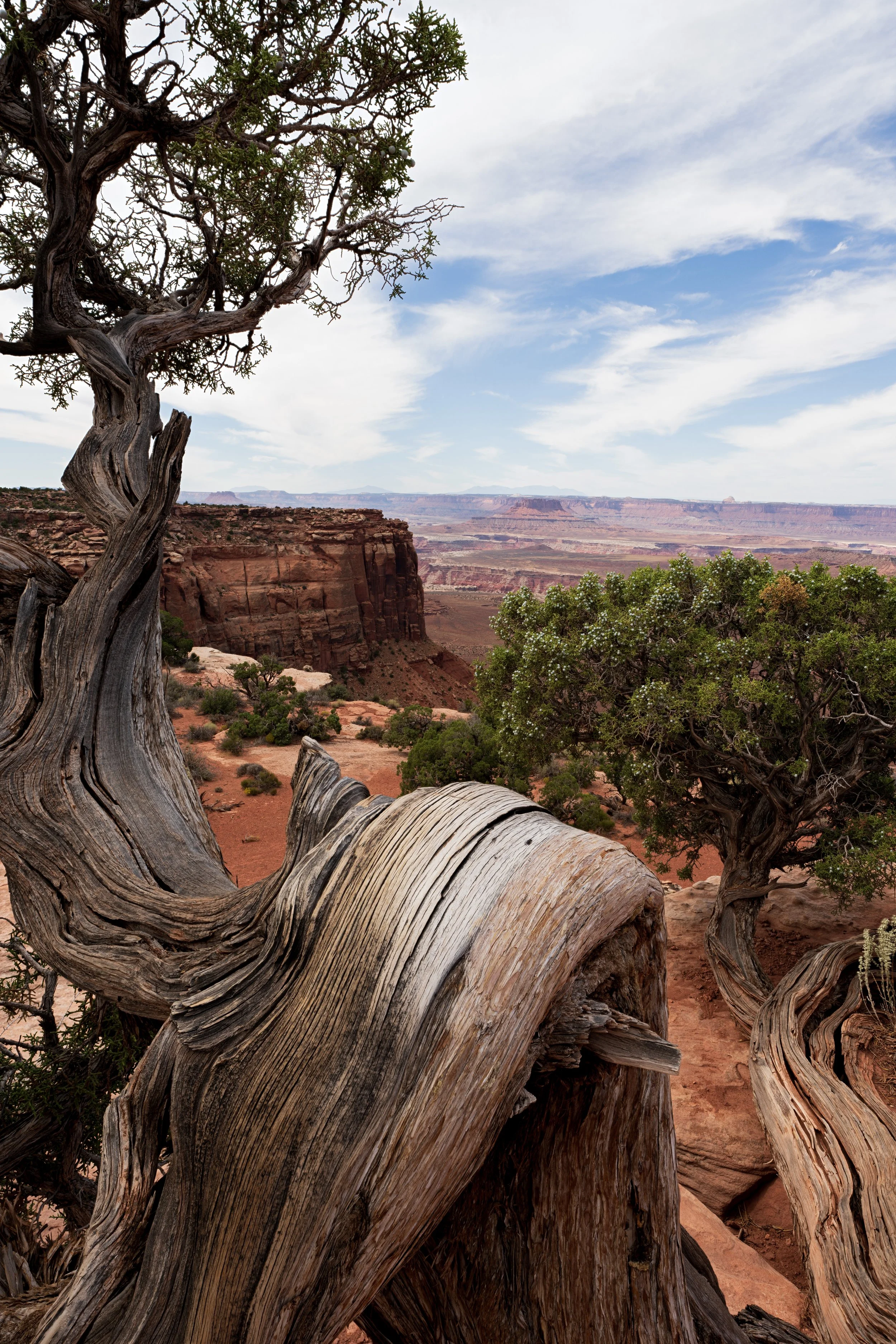
Eventually, the path leveled out at the bottom of the valley, and the green and yellow aspens of the mountain turned into the yellow-orange of Entrada Sandstone. The thick forest of the mountainside gave way to sparse Juniper trees and ancient bristlecone pines, representing the few species that seemed consistently content by the meager hospitality of this desertland. Cathedral Valley is aptly named because of the sandstone rock structures that protrude from the canyon floor, reminding an awed viewer of the feeling you get when looking at a grand Gothic cathedral. The twisting sharp spires scored horizontally across each face were unmoving sentinels on the desert floor, both imposing and mesmerizing at the same time! There was a palpable stillness here which, unnerving after the bustle of the busy city or constant birdsong and rustle of the deer in the Uintas earlier that morning. Yet, it felt very peaceful all the same. It was meditative.
After Cathedral Valley, I traveled miles down the desert wash to more unique rock structures the “temple of Sun and Moon”. After offering my unique spiritual orison at the cathedral, I was back on the flattening and widening desert road, inconveniently pocked with ditches, bumps, and steep, desiccated stream beds. The trucks wake was ared cloud of disturbed sand. It was the perfect opportunity to baptize the drone in the holy bowl of the desert, following above the truck to capture the amazing visual of the Ram humming over this unique scenery (Ram can pay me for the footage anytime!). It is important to note that the official border of the national park in this section is not well defined, but I was very careful to make sure I flew the drone only after I had exited the park boundaries. Although I always want to fly my drone everywhere, it is important to respect national park rules and regulations because they are there for the protection of the land, even if it doesn’t always seem purposeful or necessary.
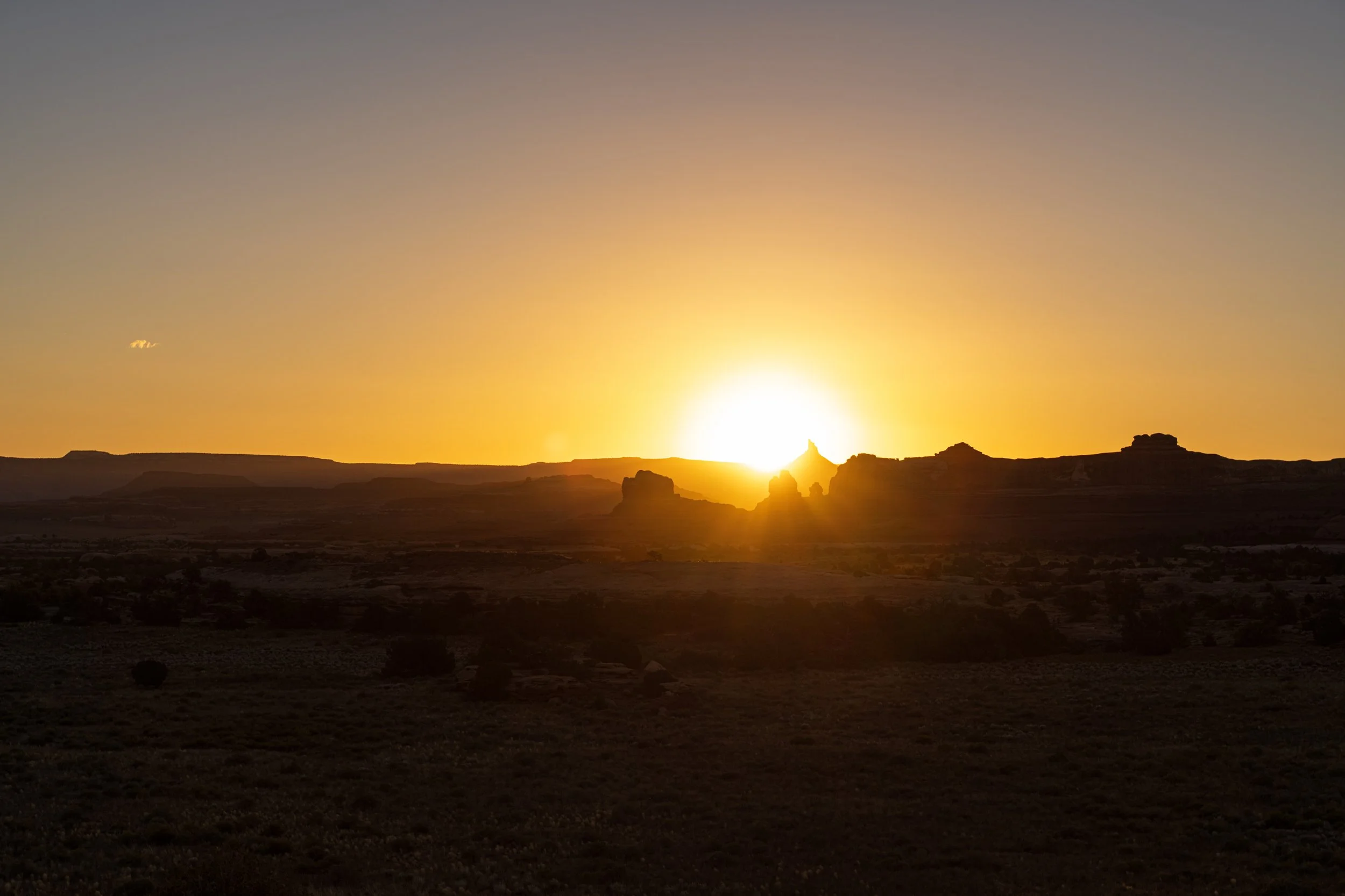
I arrived at the temple of Sun and Moon, a unique rocky landmark, an hour before sunset and was able to walk around and explore for a few minutes before choosing a suitable spot to set up a timelapse in anticipation of sunset. My reward for a long hard day was cooking the first camping meal of the trip on my tiny compact Jetboil stove. Eating and watching the clouds pass over the rock formations while the sun slowly set behind the canyon was a surreal way to end the day. I felt really happy about how my plan was manifesting, tapping into the freedom and solitude of the desert which was extremely powerful and uplifting.
At 7:45 that evening the sun was taking a well-deserved intermission but the tendrils of fading light were still providing some guidance and that meant it was time to leave. I had a long drive down the rest of the dirt trail I had been navigating to emerge further southeast at my camping destination for the night, Swing Arm City. The next hours dragged on as I trundled along the tough desert tract scattering more rocks and fording empty streambeds rerunning the bulk of my day, except now the creeping darkness was a new, uncomfortable obstacle. On the descent, I could move only at the sluggish pace of 10 MPH due to the severity of the slope, but the flat ground below permitted me to lower the pedal and ride the desert highway at a blazing 25 MPH (no need for HOV lane thankfully). After what felt like hours I emerged on Route 24, a small east-west road which leads from the main section of Capitol Reef, which was now behind me in the west, to Hanksville 20 miles to my east. Before the day ended, I pulled into the Swing Arm City OHV recreational park, a area free to camp for anyone whose car can handle the off-road terrain. Tired from a long day, I tried to investigate the conditions for optimal spots to stop but unable discern much in full darkness, so I just parked next to some dirt mounds which served as daytime ramps or halfpipes on which dirtbikes and trucks could play. I was too tired and spooked out by the silent darkness to attempt to find a photogenic foreground for my Milky Way shots, but the distant canyon walls made for an interesting enough photo. I set up my tripod behind the truck and left it out for the night.
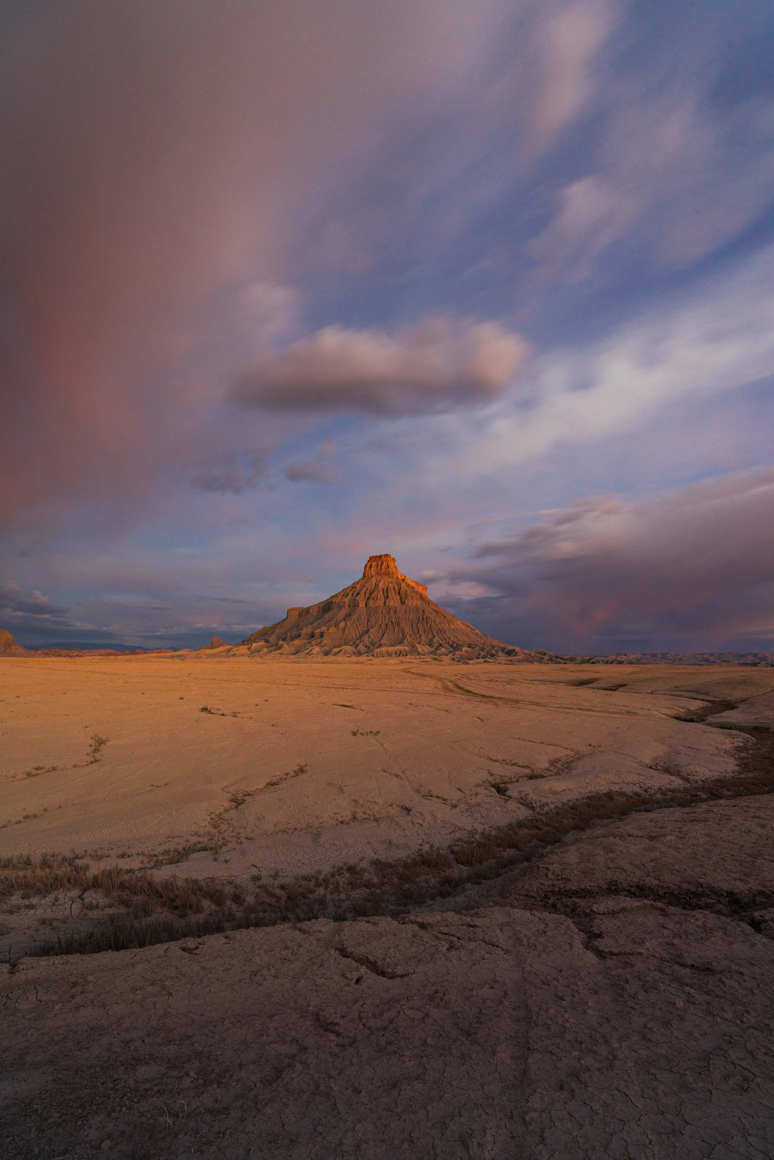
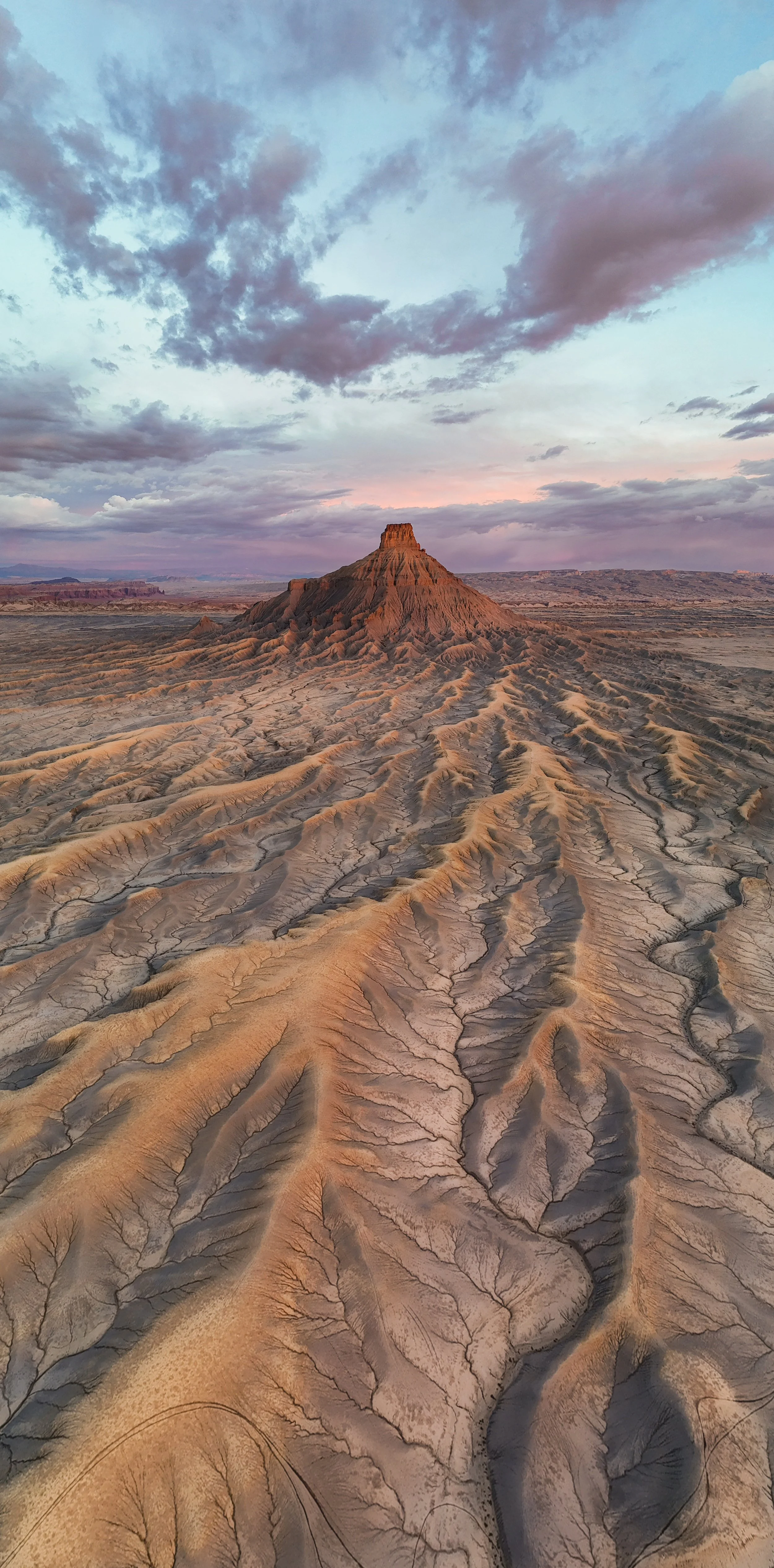
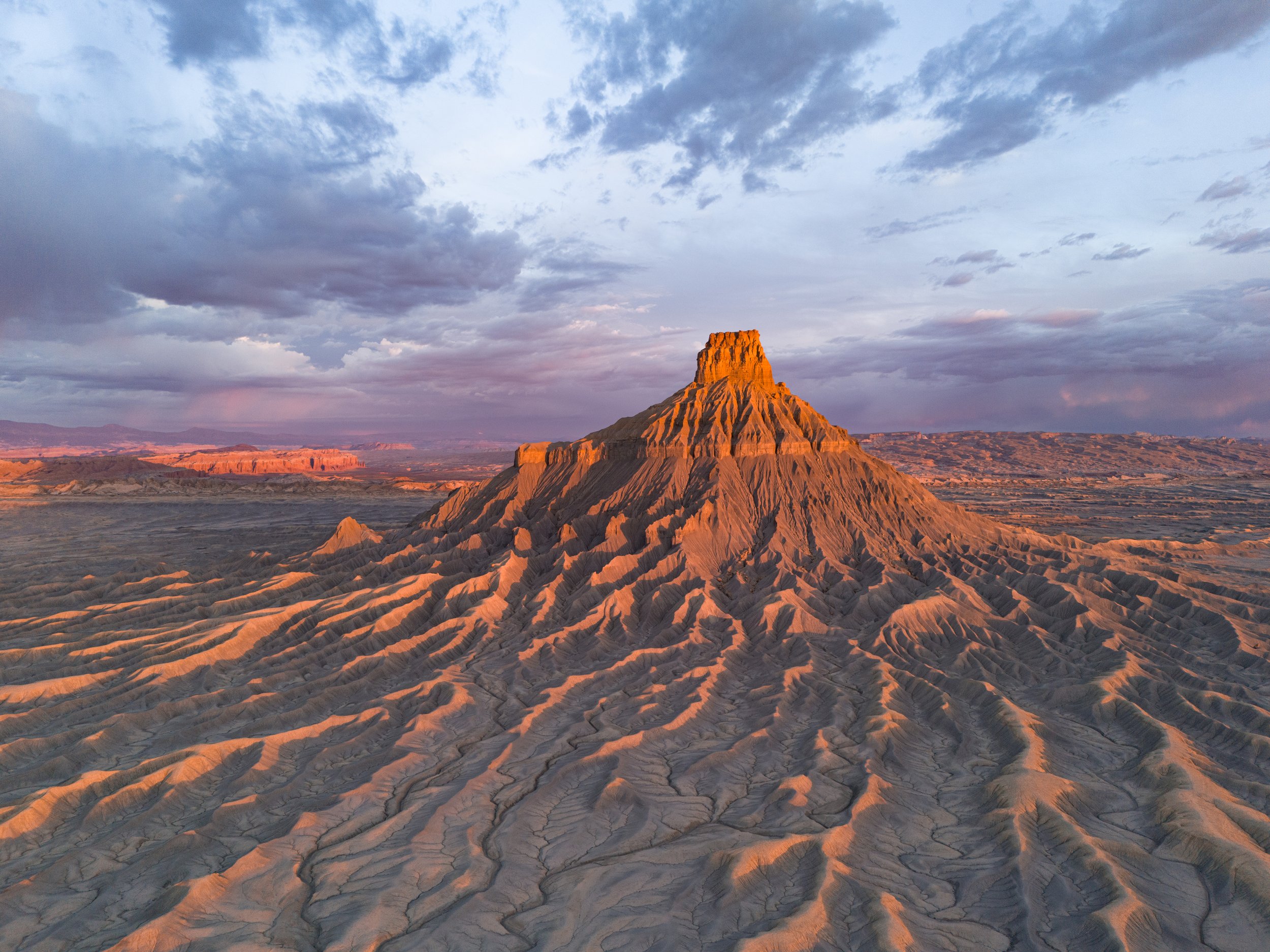
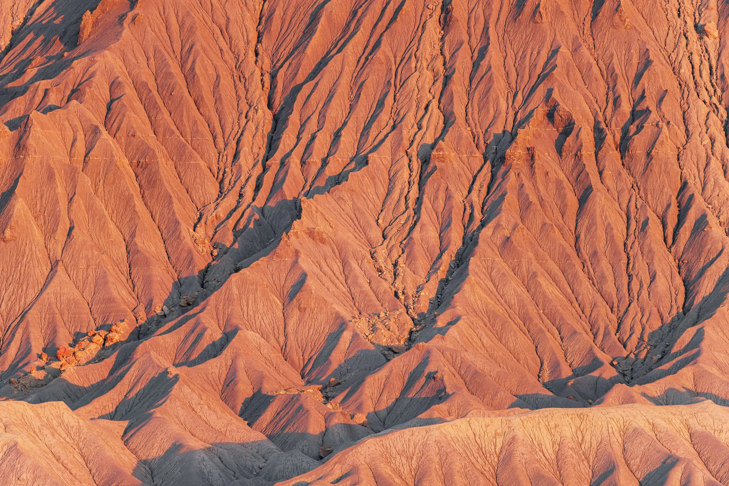
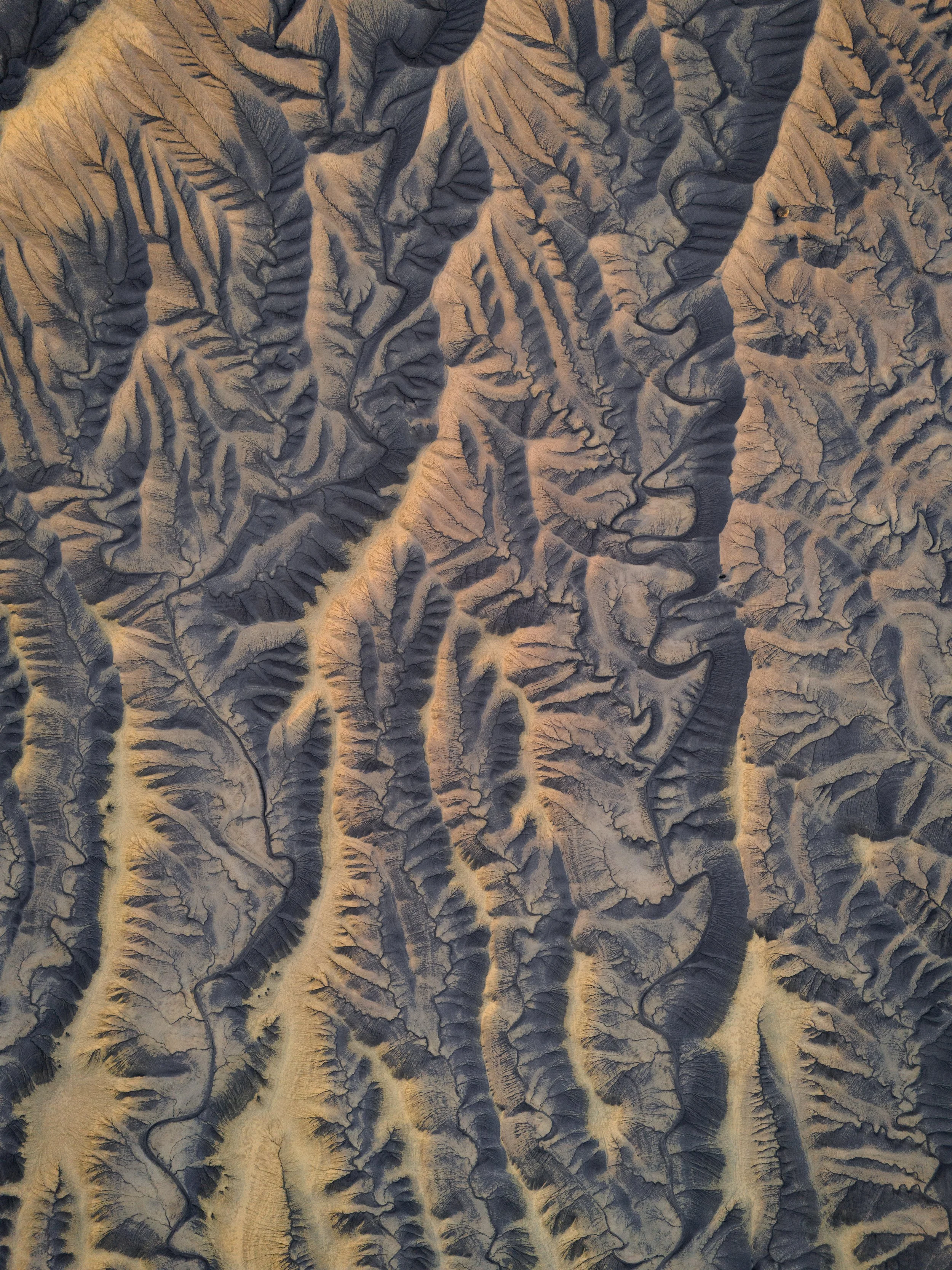
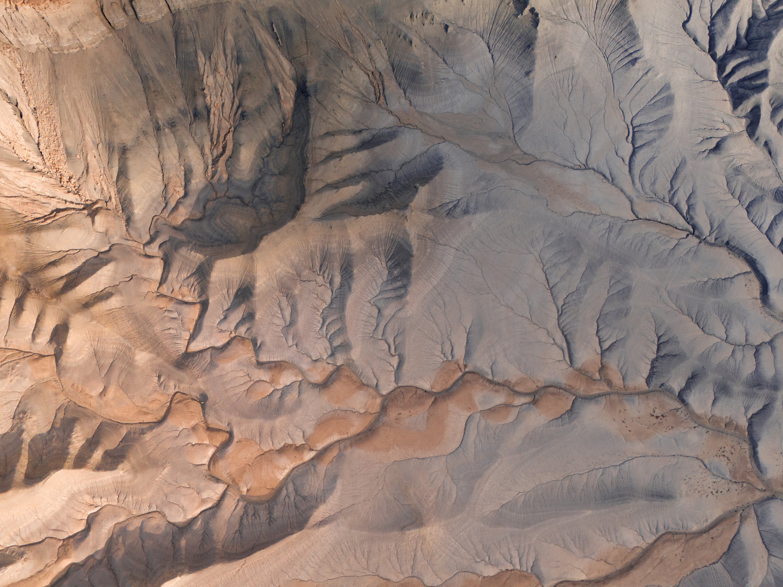
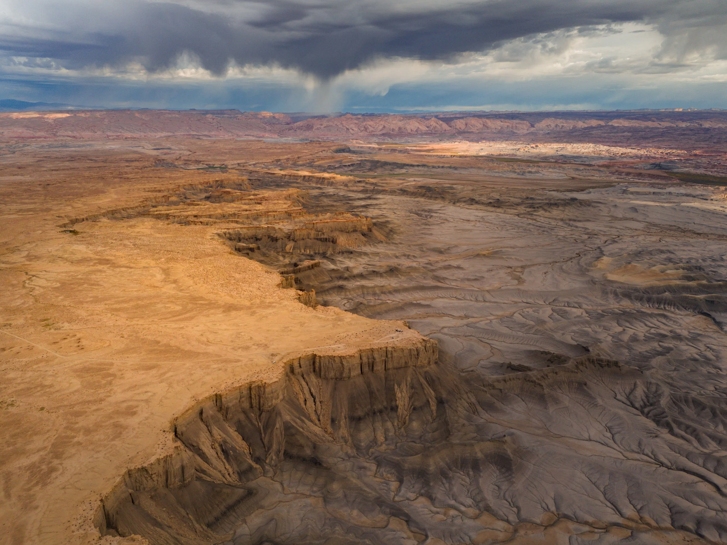
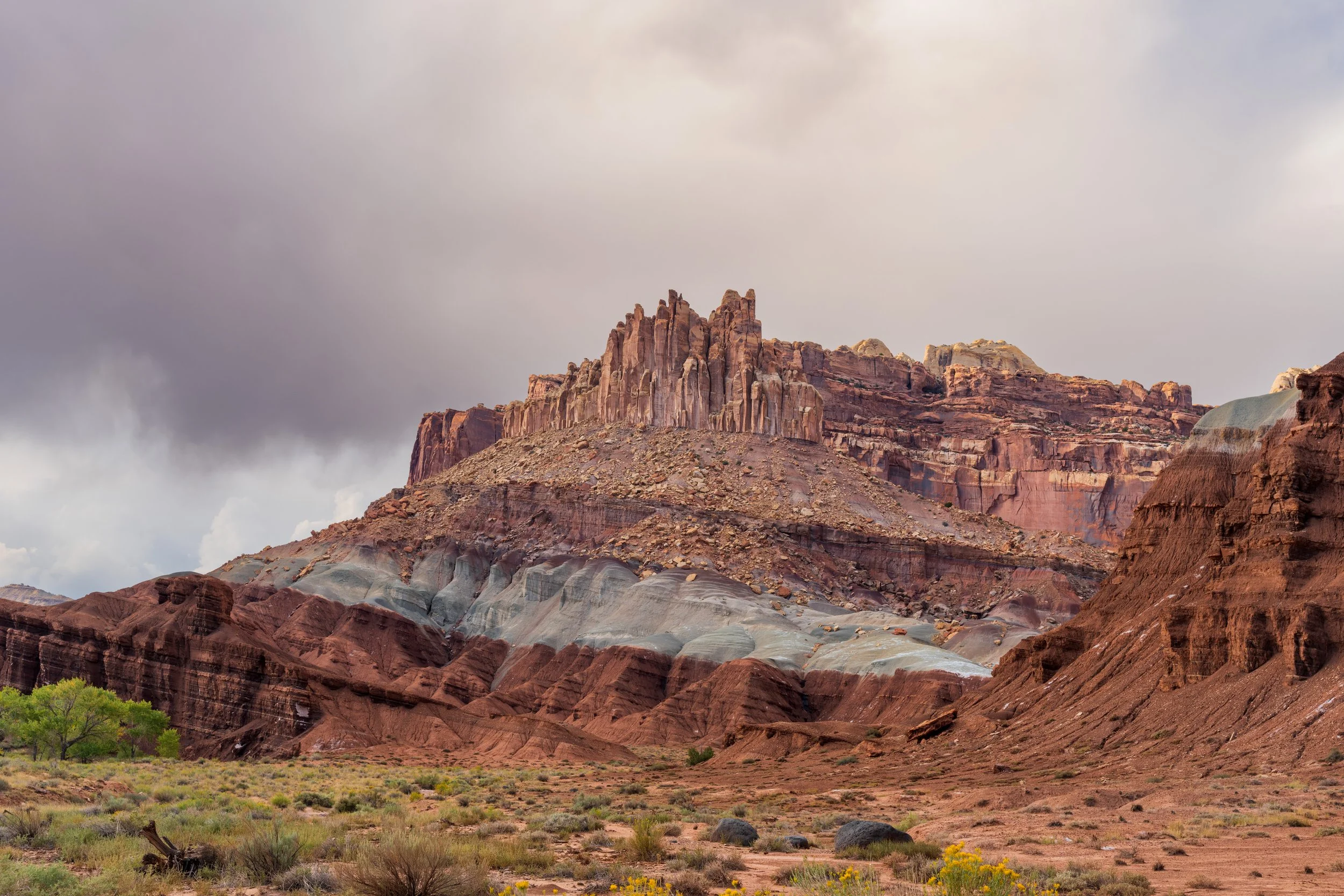
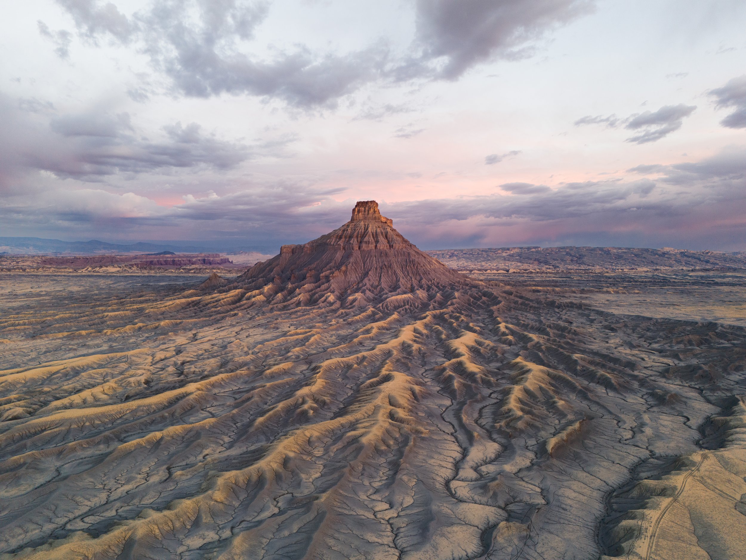
Monday morning dawned, and I was very excited because I planned to go to my most anticipated place of the entire trip to capture today’s sunrise. When researching Capitol Reef National Park, I found many references to and pictures of a large stand-alone rock formation that towers above an already high plateau in the barren land between the National Park in the west and the San Rafael Desert in the East. This area is known as the Upper Blue Hills, named for the abundance of overlying blue shale which contrasts the red and yellow of the main sandstone rock surrounding it. The rock formation is called “Factory Butte”, which suddenly juts out of the blue hills with such a unique shape that early settlers looked at it and saw a factory, a distinction that is preserved to the present. The uniqueness of each vertical ridge and rounded ribboned slope, eroded like miniature channels from the narrow top to the conical bottom by fast-moving water flows. Worn down like corrugated steel sheets cladding a natural factory that produces nothing but awe. In the morning sunlight, the eastern side is bathed in saturated orange tones, while the west side is muted and blueish. Utilizing the drone, I was able to truly unlock the beauty of this area and see just how interesting and unique it is. Factory butte has shallow shale dune-like mounds that emerge from the base and weave a path away from the rock face like giant octopus tentacles greedily searching for more rock along along the plateau. The drone provides an inspiring bird's eye perspective, capturing unique videos and stunning still shots. The sunrise light enhanced the beauty but due to storms looming in the west, the sky behind factory butte remained dark and ominous. Usually, I would have been disappointed by this outcome, but looking at the results now, I think the dark clouds embellshed the overall aesthetic, injecting a sense of mystery over the landscape and enhancing the butte’s beauty.
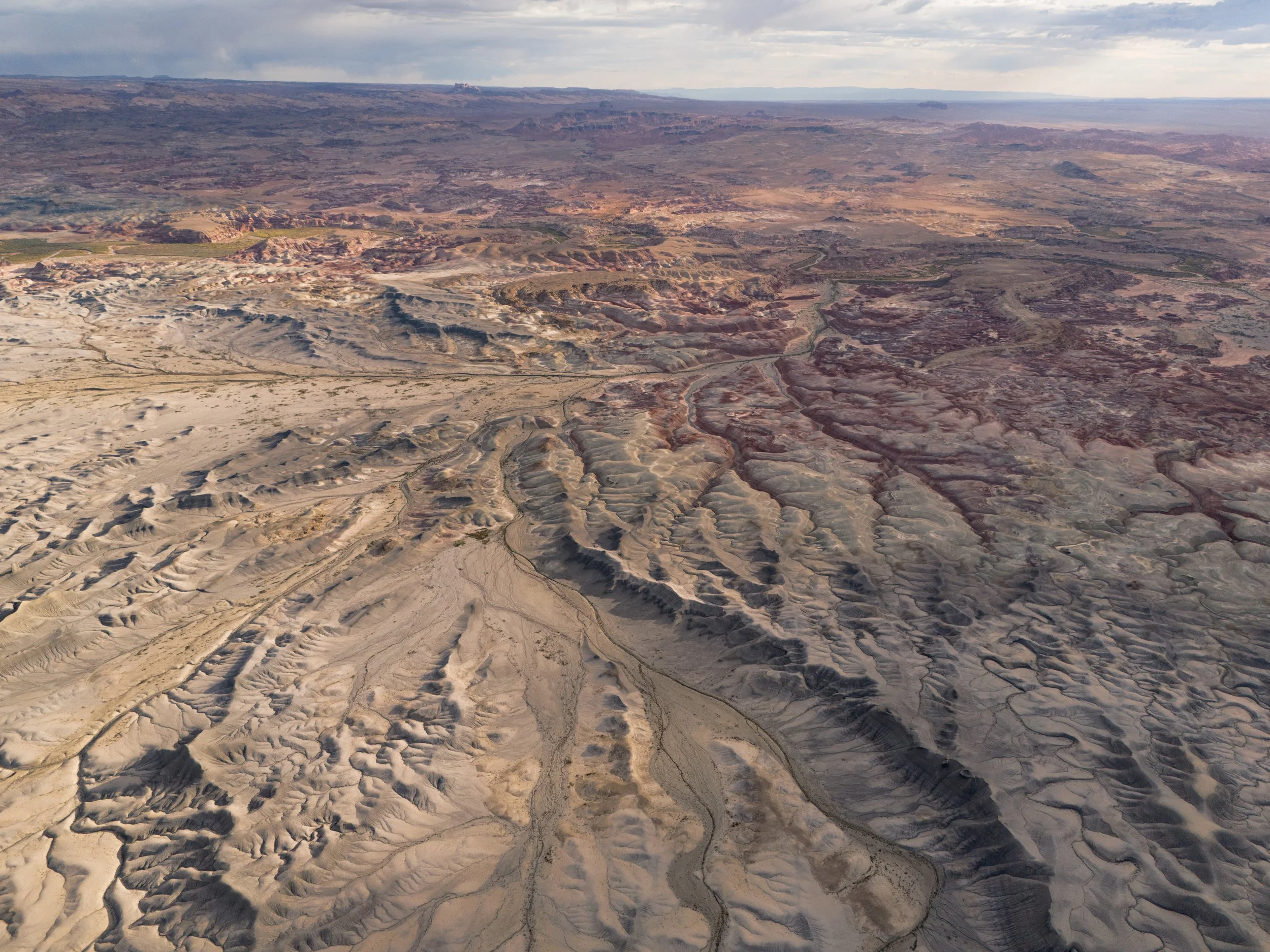
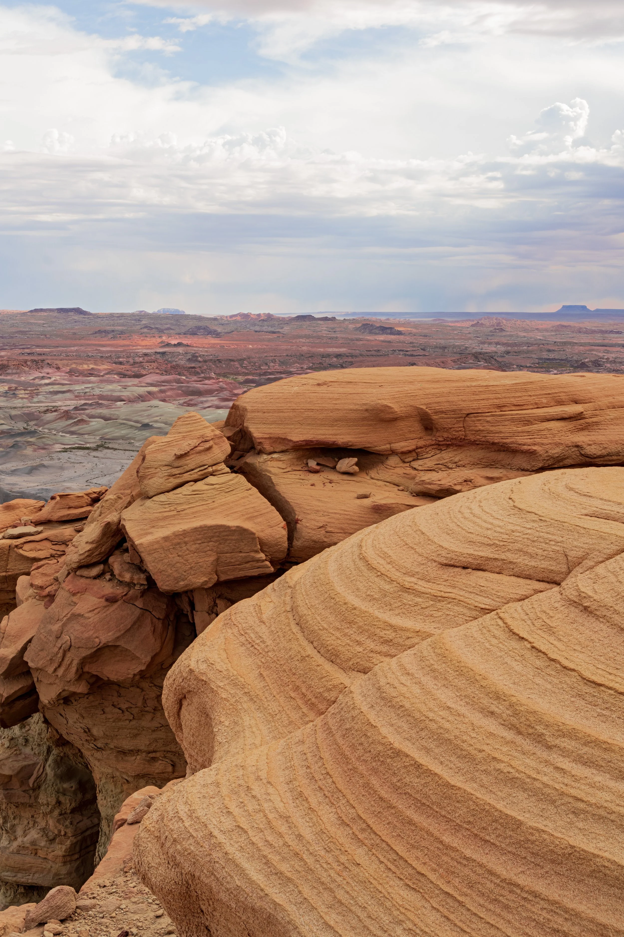
Sunrise finished and the soft light faded, I drove to the edge of the Cainsville plateau cliff to an overlook offering a 180-degree view of the wash below. Blue shale and painted bentonite hills greeted my sight. Here, I busied myself putting down time-lapses and flew my drone to capture the gathering, distant storms. The texture of the cracked and craggy earth commanded my attention as well, and it was hard to know what to focus on. Finding time between these bursts of creativity, I sat for 10 minutes to make coffee and oatmeal with lightning flashing in the distance. I could not have dreamed of eating breakfast under these conditions, and it was special to see a side of the desert climate that is not often viewed. It was a very special morning!
Eventually, peak excitement wore off, and I was looking around for new ideas on what to do. It felt like 6 pm but the clock revealed that it was only noon. Already, I felt as if I packed a full day of photography into just these morning hours. This is how landscape photography is meant to be done, highly situation and light dependent, getting up early and going back out late with some downtime to rest in the middle of the day, and this was the first time I truly got optimized for that schedule.
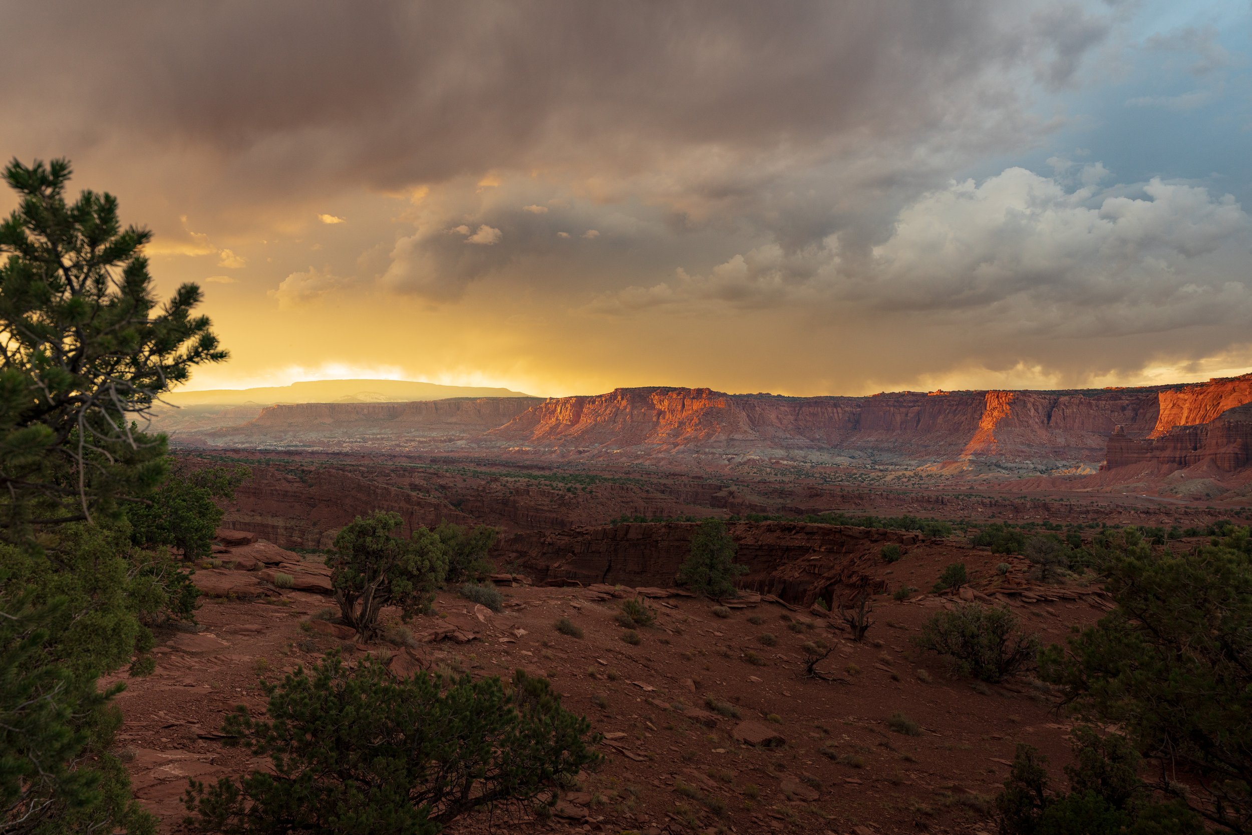
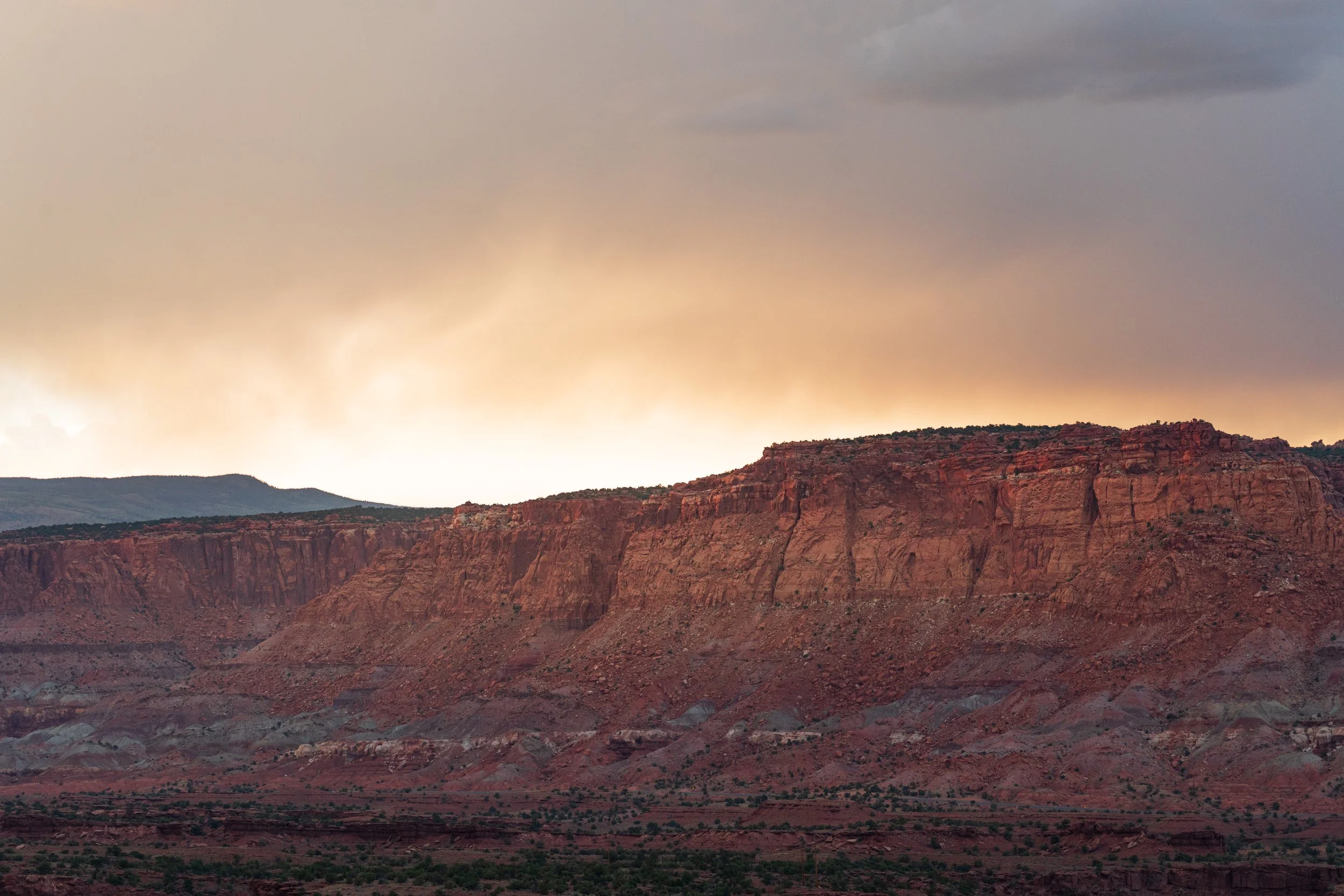
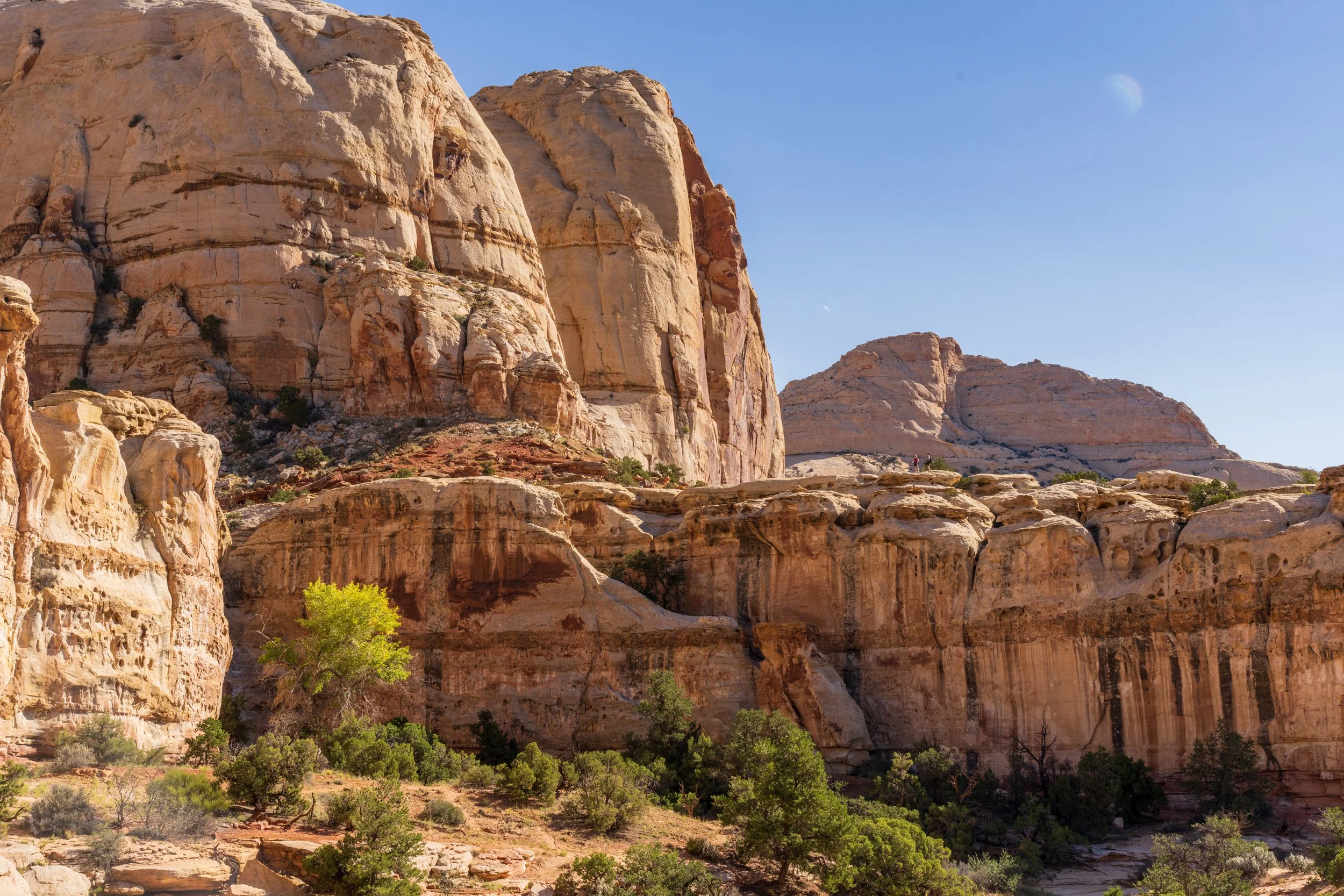
I spent the early afternoon taking videos and pictures with new friends made on the plateau, as they took their Ford Raptor trucks to Swing Arm City OHV and drove up the wall faces at dizzyingly steep angles. I was even given the opportunity to ride along in one of the trucks as it defied gravity. As we arced over the desert mound at speeds way too fast for someone so risk averse I was thinking about how I got here, but thats what the desert does when you embrace the spontaneity. Later I broke from my plan (again!) and decided to drive into the main terminus of Capitol Reef, which most people initially visit at the national park. I originally intended to bypass this area because my focus was on the rugged backcountry, but now I felt like it would be wrong if I didn’t see at least some of it. The “Reef”, which the park gets its name from, is just a steep and long north-south cliff that impedes travel, as an ocean reef does with ships. As I drove along it, I experienced its remarkable vastness, and found that main road has a few cool viewing points, so what else was I to do but to stop at each to snap more photos! Following this side trek, I hit the road for Panorama Point and Gooseneck Overlook to capture the day’s sunset. Here, I was once again treated to an amazing display. In daylights final hour, dark storm clouds loomed in the west, and curtains of misty rain started falling over the cliffs. As the sun disappeared behind the cliffs, these low clouds and mists of rain illuminated brilliant orange sheets and bathed the entire landscape in a warm and pleasing glow. The fun came to an end when the rain moved overhead, forcing me to rush around collecting all my photo gear, which was scattered from capturing different angles of the sunset, and run to the car. After an entire day encompassed by rain and storms, I finally got a sip of the desert rainy season!
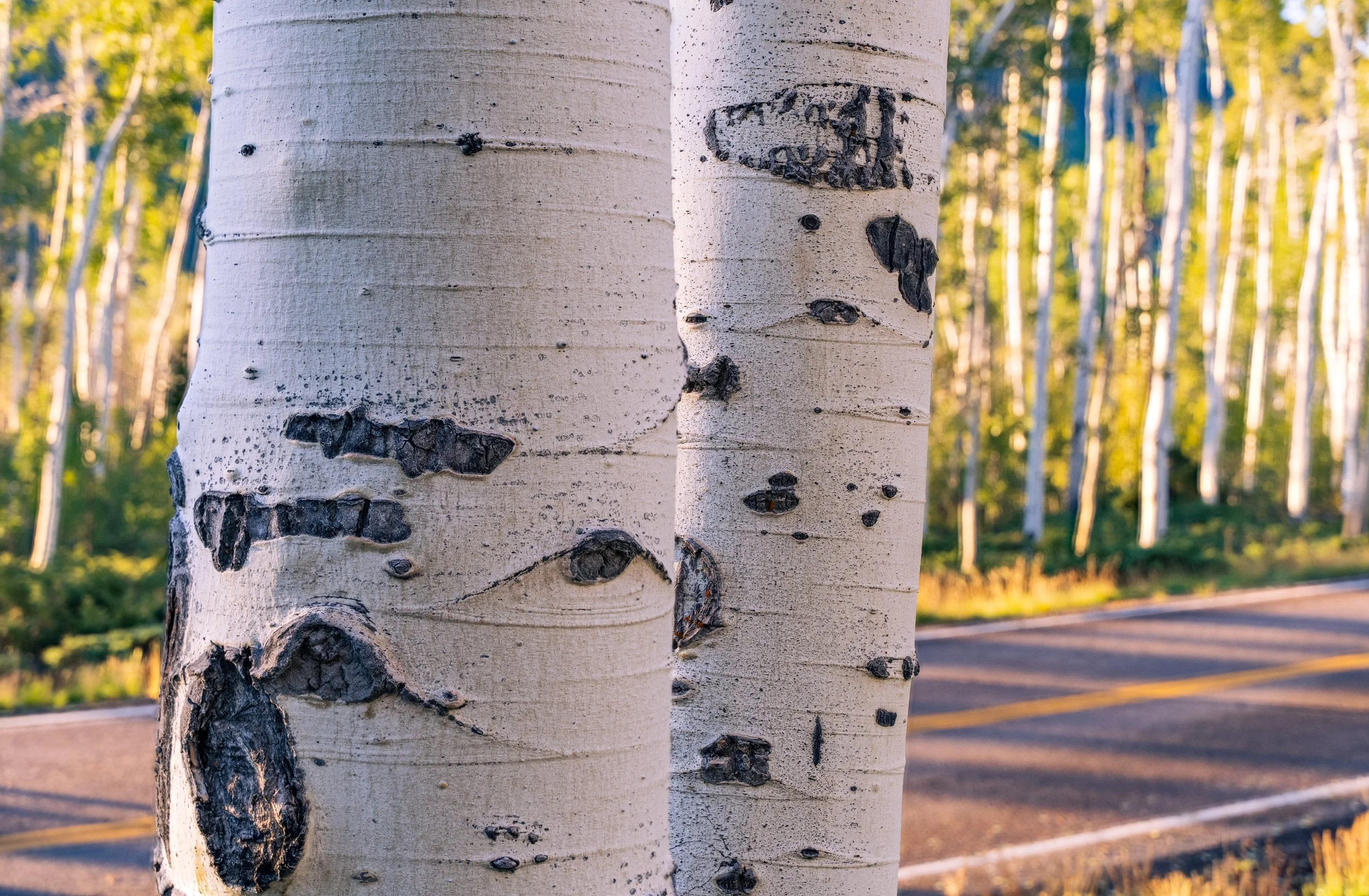
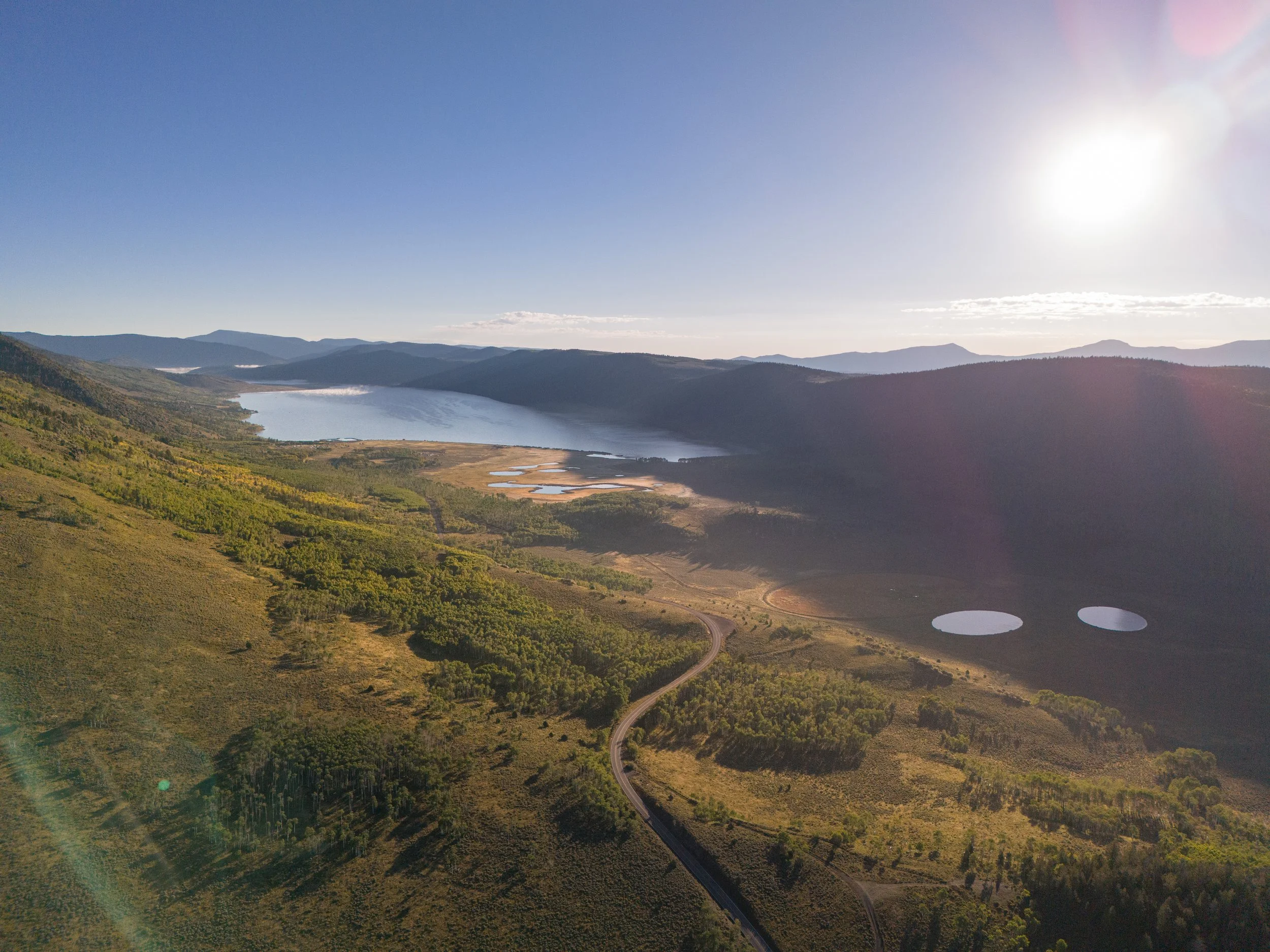
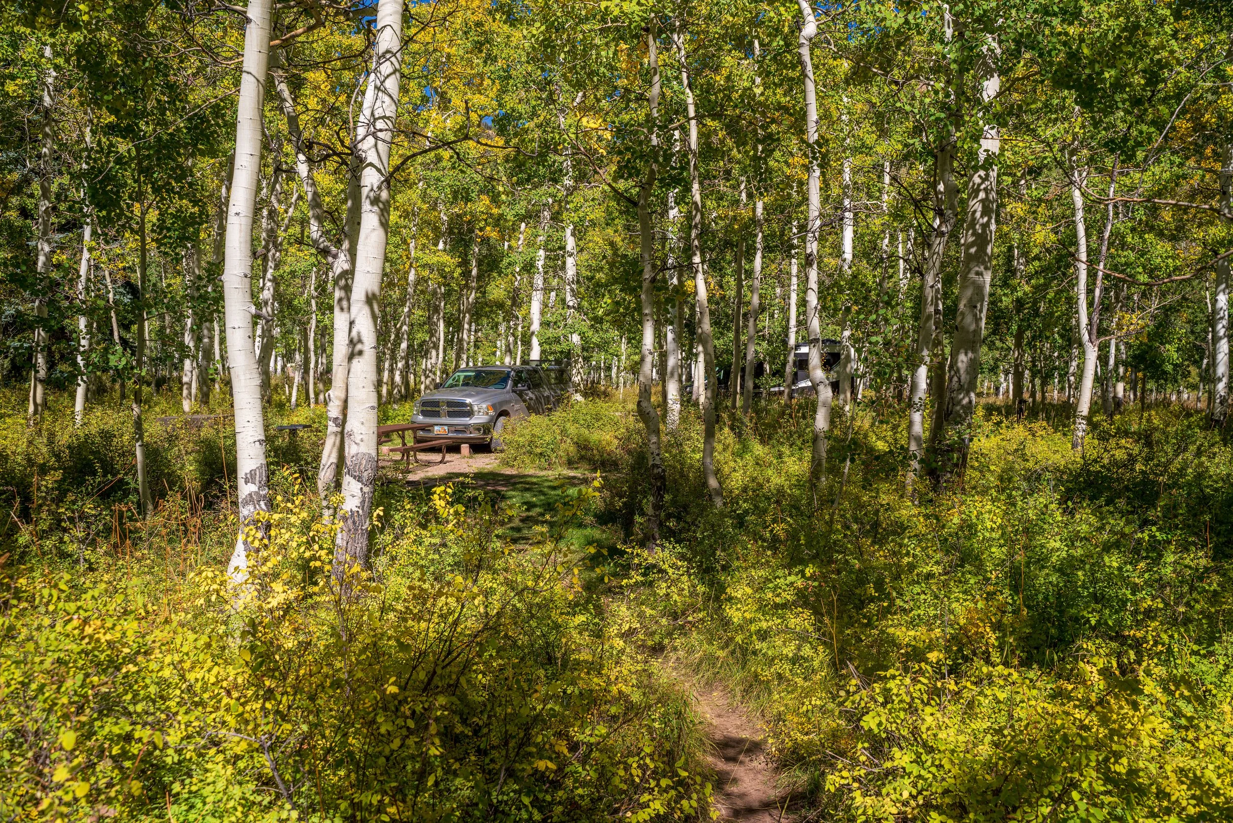
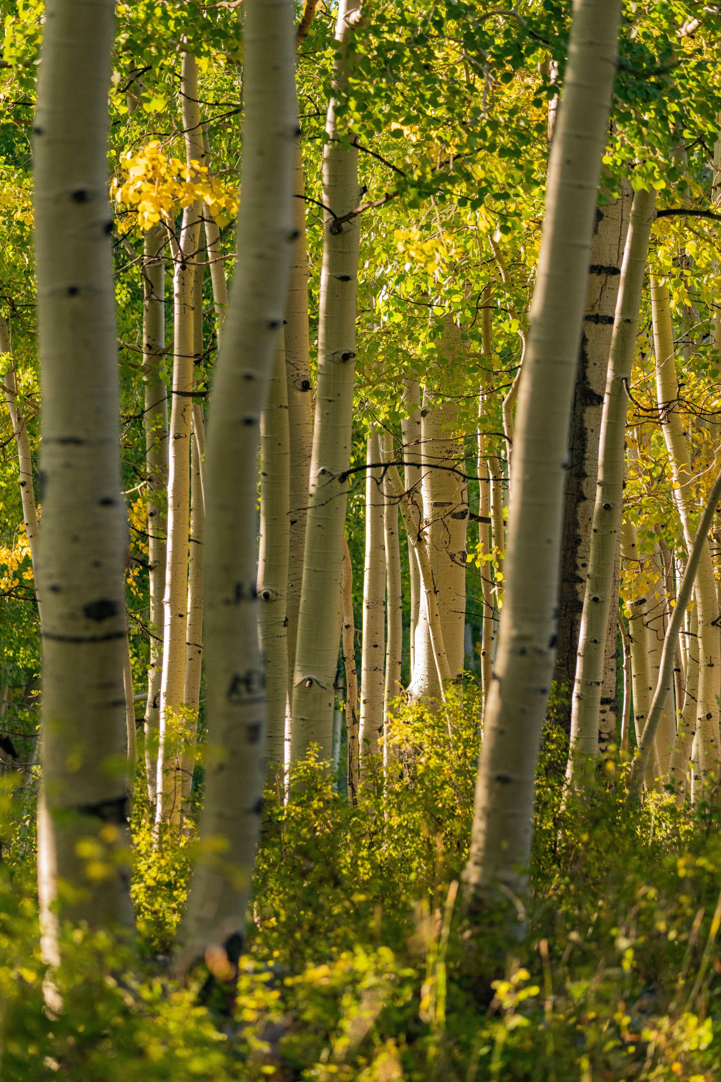
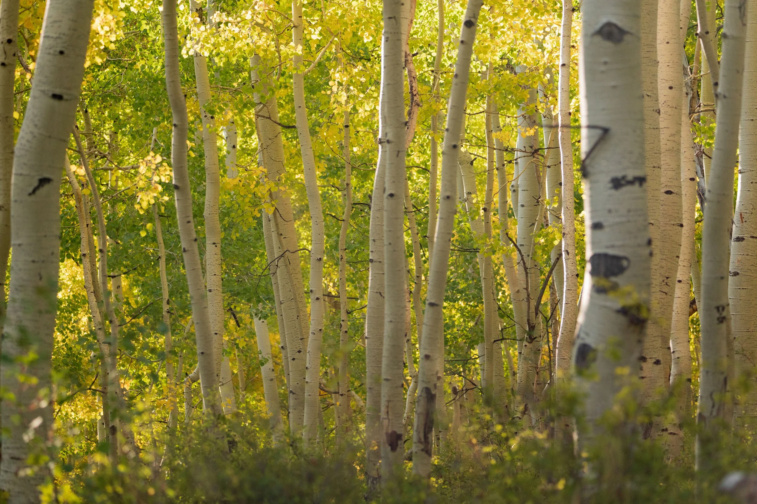
The next day, Tuesday, I headed further west to Fish Lake, a mountain lake 9,000 feet above sea level tucked in an alpine valley, where already in September all infrastructure was closed for the “winter season”. The morning was a balmy 35 degrees when I arrived. This stop is a detour from the otherwise eastward exploration of my plan, because I had discovered during my pre trip google earth combing a unique cluster of trees that call this lake home and I became eager to see it for myself. All across Utah, especially in high-elevation areas, aspen trees are abundant. Aspens are distinct, chalk white with black “burn” like pits dotting their trunk, which are tall and slender with a high clusters of leaves. They are often seen in dense groves where they dominate, resulting in a lack of tree diversity around them. Aspen have unique reproduction that results in their dominance, stated best by the United States Forest Service: “Aspen is noted for its ability to regenerate vegetatively by shoots and suckers arising along its long lateral roots. Root sprouting results in many genetically identical trees, in the aggregate, called a ‘clone’. All the trees in a clone have identical characteristics and share a root structure.” On the banks of Fish Lake lives what scientists believe to be the largest single organism (defined by genetically identical DNA) in the world called the “Pando Aspen Clone”. This 13 million-pound tree network spans 106 acres and consists of 40,000 individual tree shoots which all originated from a single seed but just appear to be an entire forest of individual aspen trees. I arrived before sunrise and walked through a small section of this grove as the sun crept over the mountain. It was very cold and much of the clone is currently protected and not accessible to visitors, but it was still cool to walk amongst this unique tree structure. I couldn’t help but wonder at this seemingly unobtrusive forest, which was one large and powerful organism with many different growths that all give it strength and keep it alive. With the rest of the lake shuttered for the winter, I finished pondering Pando Aspen Clone and resumed traveling east.
While driving back towards Cainsville and Hanksville early Tuesday morning, I noticed a busy pull-off parking lot a few miles from the entrance of Capitol Reef. Curious, I pulled in to see what all the commotion was about and discovered that there was a 2-mile hike to Hickman Natural Bridge. This was perfect because I did not have much else on the day’s agenda since I could not stay at Fish Lake. Before hiking to the bridge, I ate a quick breakfast of oatmeal and coffee in the parking lot while eager tourists glared at me for being so close to my car but not abandoning my highly valuable parking spot. What else is a hungry man to do?
Refreshed and ready, the hike proved not very strenuous; it was nothing more than a sharp climb up natural rock steps to the top of the low canyon wall which makes up part of the northern “reef structure”. From there, I proceeded farther onto the plateau until finally descending along a winding path into a small rocky depression. The myriad tourists gazed at the giant rock bridge spanning the depression above, linking two parts of the rock formation. The ease of achieving the view certainly explained the crowded parking lot! The bridge was very striking and the hike made for a nice change of pace. It was a welcomed salve for an otherwise ruined day.
Now it was time to make my way back through Cainsville and start blazing a new trail North and east towards Moab. If all goes well, I will get to stop by two very small and underrated state parks which I might enjoy even more than the big national parks!

Part 3: Goblin Valley & Dead Horse State Parks
Any time I have talked to people about visiting Utah, I always receive the same few recommendations: “Go to Arches! Go to Canyonlands! Visit Bryce Canyon and Zion!” While those are beautiful national parks more than worthy of a visit, their eminent reputations can deter further effort to explore Utah’s other, equally impressive natural wonders. As I left the Capitol Reef region, my Rocky Mountain high from 2 days of really great shooting was boundful, but as I moved farther away and got closer to the next stage of the trip, I started experiencing a rapid decline in energy and a creeping anxiety surfaced from out of nowhere. I was struggling to get into a groove and when I arrived at Goblin Valley around 2 pm, I was not mentally ready to explore the park. I knew I wanted to see the sunset and capture Milky Way pictures here, but I needed something to refresh my body. And a nice hot shower seemed likely to fit the bill!
Because I am not staying at any official campsites or hotels, showering was one of the things I would need to improvise along the trip. I received sage travel advice from my Uber driver on the way to the airport that truck stops usually have shower rooms for small fees. When I first arrived in Goblin Valley to purchase my entrance pass, I quickly changed my mind. I turned the Ram around and drove an hour farther to a tiny roadside town, Green River, and gave the truck stop shower experience a try! My honest review is that this is a great option for transitive people with no other access to a proper bathroom for extended periods. For me, it was very weird at first, and required a bit more than a “small fee.” For $17, I received a private shower room, towel, and a hotel bar of soap. While I’m naturally inclined to the cheap, it turned out the $17 was well spent, as feeling clean and refreshed restored my vigor for the next half of my adventure!
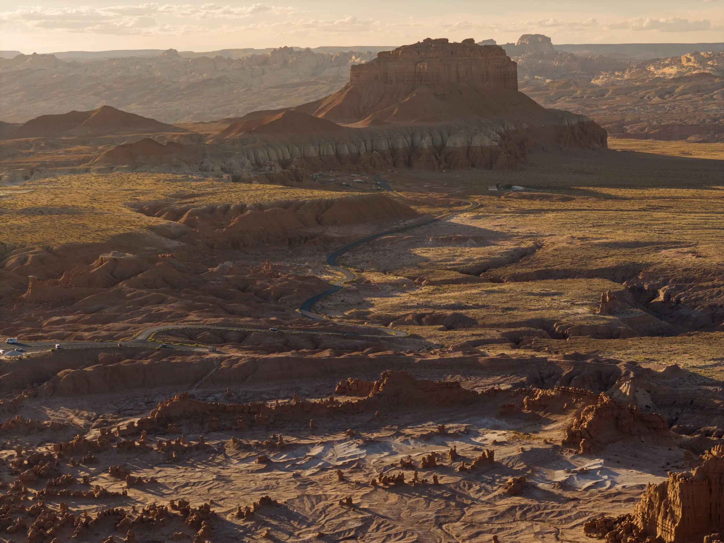
Yet, on the drive back to Goblin Valley, my anxiety raged back. Traveling on the flat desert road with nothing interesting to keep my mind busy and a lot of overwhelming logistical thoughts swirling around my brain; I was having trouble dealing with it. I kept telling myself that I just needed to get back to the park so I could relax and eat, and then hopefully my anxiety would clear up. The next few hours were very important for me because having bad anxiety could have easily derailed the day, which would only send me spiraling into a worse state of mind. I entered the park and reached an overlook. Below me, “goblins” sat still, and I snacked beef jerky and drank water at a picnic table, writing in my travel journal for over an hour. This period in which my cells energized and my mind unburdened several days of observations calmed my being. I was happy my mood did not disturb the goblins, either.
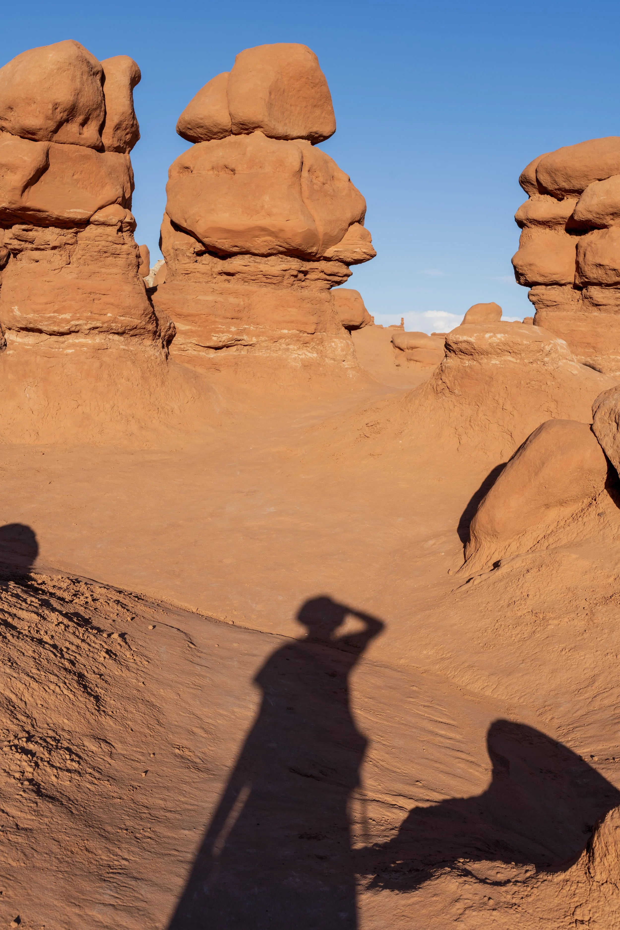
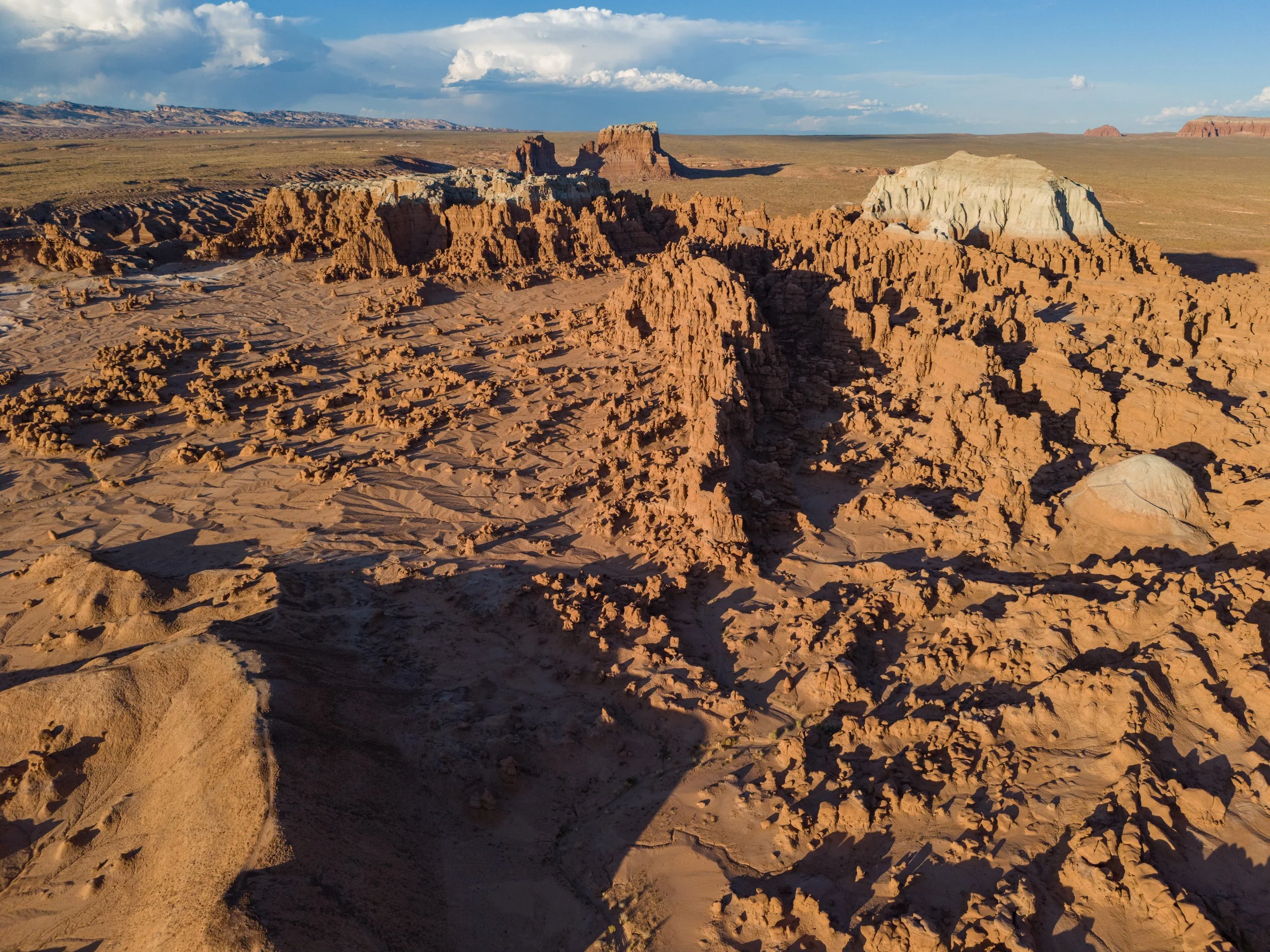
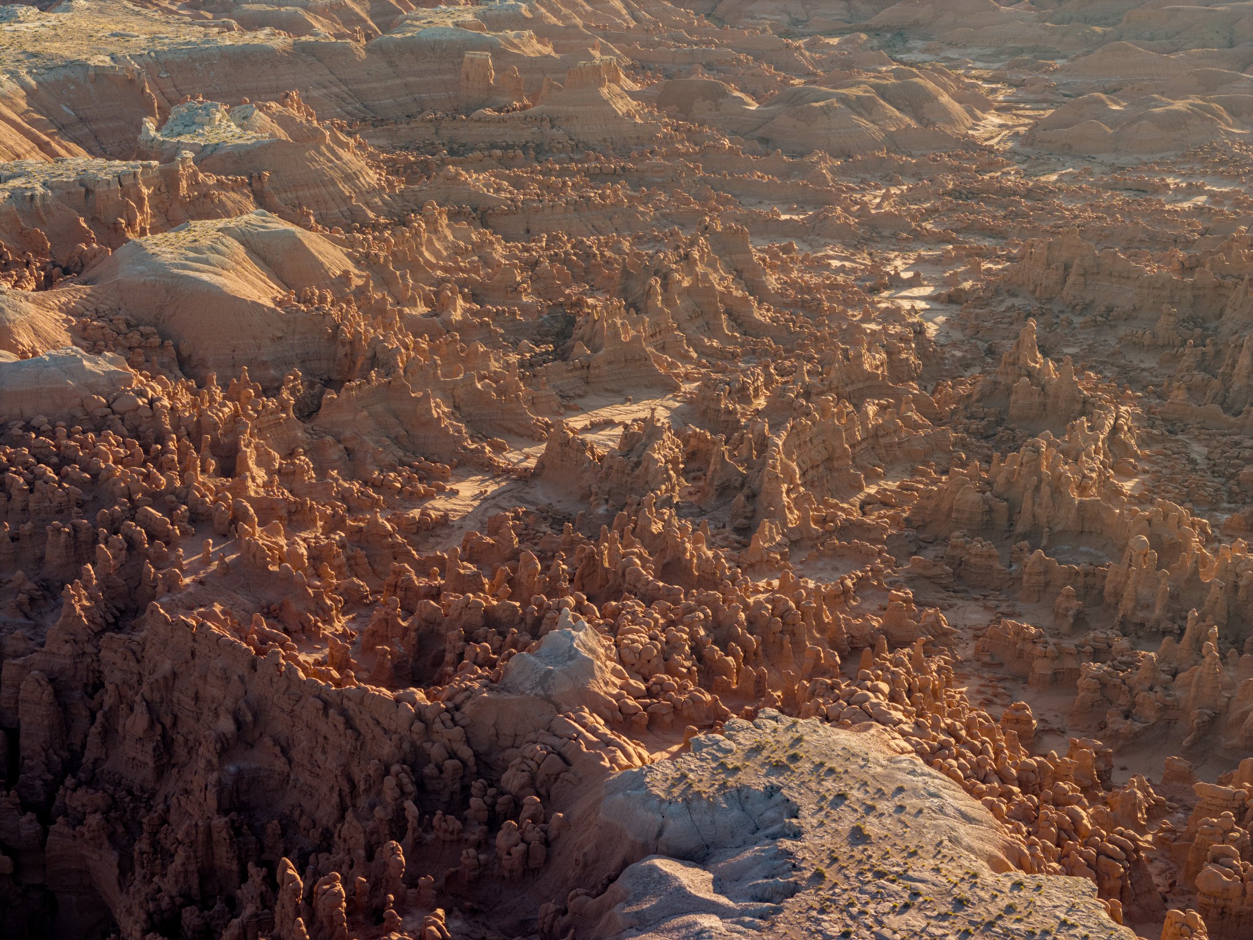
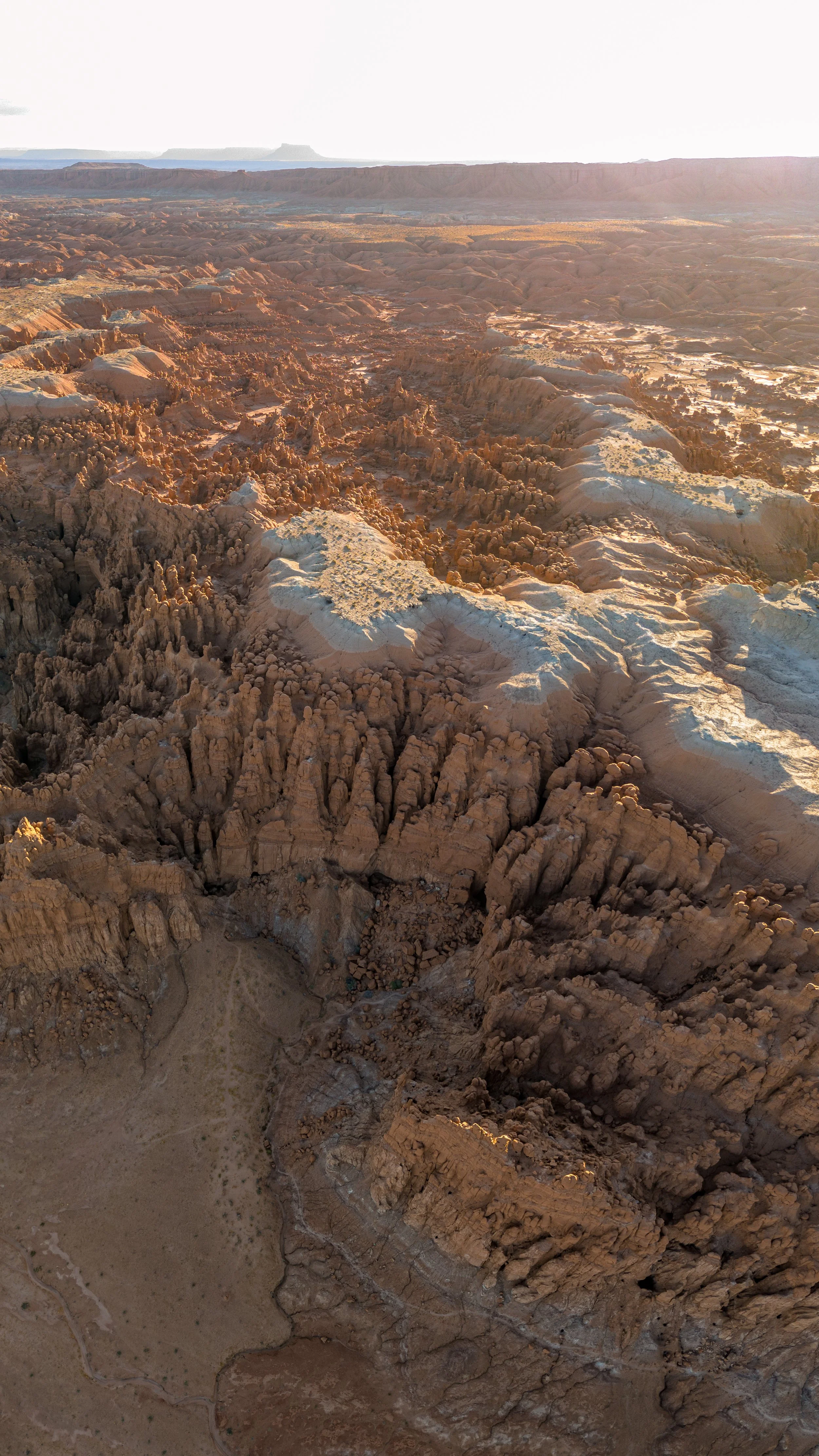
Maybe I should pause to explain for anyone confused about these goblins, which give the park its name (because I know I was confused). While it would have been cool if little real-life goblins were living here, it is refers to rock formations called “goblins”. These small, mushroom-shaped rocks, some 3 feet and others 8 or more feet tall, fill a dusty red valley as far as the eye can see. According to the official park website, this unique area was formed mostly due to erosion and the soil/rock composition here. “Goblin Valley State Park is a showcase of geologic history. Exposed cliffs reveal parallel layers of rock bared by erosion. Because of the uneven hardness of sandstone, some patches resist erosion much better than others. The softer material is removed by wind and water, leaving thousands of unique, geologic goblins. Water erosion and the smoothing action of windblown dust work together to shape the goblins. Bedrock is exposed because of the thin soil and lack of vegetation. When rain does fall, there are few plant roots and little soil to capture and hold the water, which quickly disappears in muddy streams without penetrating the bedrock.”
I was reaping the benefits of thousands of years of erosion, strolling through the little goblins in a very otherworldly storybook locale. They surround you, unmoving and silent like an army was lining up for battle and a volcano erupted leaving them standing sentinel forever in caked-in stalagmite coffins. I took photos of the scene and flew my drone (they sell day permits for drone use at the visitor center, a very cool and novel idea I think more parks should do) to see the landscape from a unique overhead perspective. I also crucially scouted out a location in the valley that looked good for setting up my tripod and slider to capture a Milky Way timelapse later. Usually, when doing astrophotography I am forced to walk around blind in the dark trying to find a good composition because I have a habit of leaving myself no time for scouting and planning when I arrive at my locations. But on this trip, I wanted to be better, and getting here early was a great decision. Marking my location on the map for later I walked back to the car to make dinner and relax in anticipation of a busy sunset and prepare for my overnight shoots. I thought that this would give me some more nice downtime, but the weather changed that plan.
As I was prepping my camping meal for the night I noticed that out to the north, there were a lot of dark clouds with interesting and complex structures swirling and moving my way (but not overhead thankfully). Soon the lightning started in the distance and it was as if my dreams were coming true again because I love storm photography. The best way to capture storms is to set the camera up for a timelapse with a slow shutter speed (1-2 seconds if it is dark enough) and to leave as little time in between photos so that if any bolts of lightning strike, the camera is almost always capturing a photo. I set up my camera at the edge of the parking lot and was finally free to open a beer, boil water for dinner, sit in my camping chair, and watch the storm rage in the distance. This was extremely therapeutic for me, and as I sat watching the scene unfold around me, I was reminded just why I do this. I did not have the best day earlier due to anxiety, hunger and weariness, but seeing the storm’s power and beauty and knowing that my planning and preparation set me up to capture it all was very validating and empowering. As the sunset faded into dusk, then complete darkness, I was ready to execute my Milky Way photography plan. I gathered my tripod, slider, capture cords, light for foreground, camera, and headlamp (photography is not always as easy as you might think) and marched down onto the goblin graveyard to find my selected spot.
One thing that has always been difficult for me with nighttime photography is that being in an unknown location in the middle of nowhere in pitch-black conditions can be very scary. I have never had a crippling fear of the dark, but I still get the creeping fear of the unknown when I can’t see my surroundings. This is not a new feeling; it almost always happens when I shoot at night alone. But I have learned that you cannot give in to fear, and to get the best results you need to face that fear and plunge into the unknown with confidence and a level head. I wound my way through the goblins to my chosen location and set up my timelapse, starting the sequence slightly before the Milky Way was visible. I left it out for the next 3-4 hours. In the meantime, I drove down the road to another area of the park. Using my my second camera, I captured the Milky Way at a rock formation called “The Three Sisters”. This was also really spooky and eerily silent, but worth it because the pictures I got from that location are awesome! The hard work completed, I sat in my camping chair and stared at the sky enjoying the simplicity of watching the stars go by. It is always important to take time to just sit and stare at the stars because it is rare enough to have such a dark and pristine sky that allowing the camera an opportunity for a good view without affording your own eyes the same luxury would be criminal.
After completing my astrophotography and stargazing, I needed to find a place to stay for the night. The campsite at Goblin Valley was already full by the time I had arrived, and in my plan, I had assumed it would be easy to just stay in the parking lot of the overlook. In practice, I did not feel comfortable doing this now. Maybe it was all the goblins! Luckily, because of the extensive planning and research of the region, I knew the BLM (Bureau of Land Management) had campgrounds dispersed around Moab. The next day, I planned to visit Dead Horse State Park which is right outside Canyonlands National Park and close to Moab. I located a BLM campsite close to both parks and, leaving Goblin at 11:30 PM and completely exhausted, I was determined to complete the drive before morning! Two hours further east, I said goodbye to the San Rafael desert until some uncertain future. After passing through Green River, home of my $17 shower, I blazed a new path east to Moab, excited to experience a new section of Utah for the first time.
I eventually rolled into Lone Mesa Campground, a no-frills, “first come, first serve” loop after a drowsy and dark drive through the nothingness in between central and east Utah. Given the lateness of my arrival, there were already many cars lining the campsite boundary, seemingly all of them opting to sleep in their vehicle rather than set up a tent in the howling wind and cold. I was lucky to find a small space on the edge of the bluff, parking between the other wanderers, and huddled into the back of the truck bed to scratch out a few extremely necessary hours of sleep before another early predawn wakeup for more photography. Waking up prior to sunrise will never be easy for me, especially because my body refuses to go to bed at a reasonable hour. But when properly motivated, such as the prospect of experiencing a golden orange sunrise in a new and interesting place, I can drag myself out of bed and get going without much trouble.
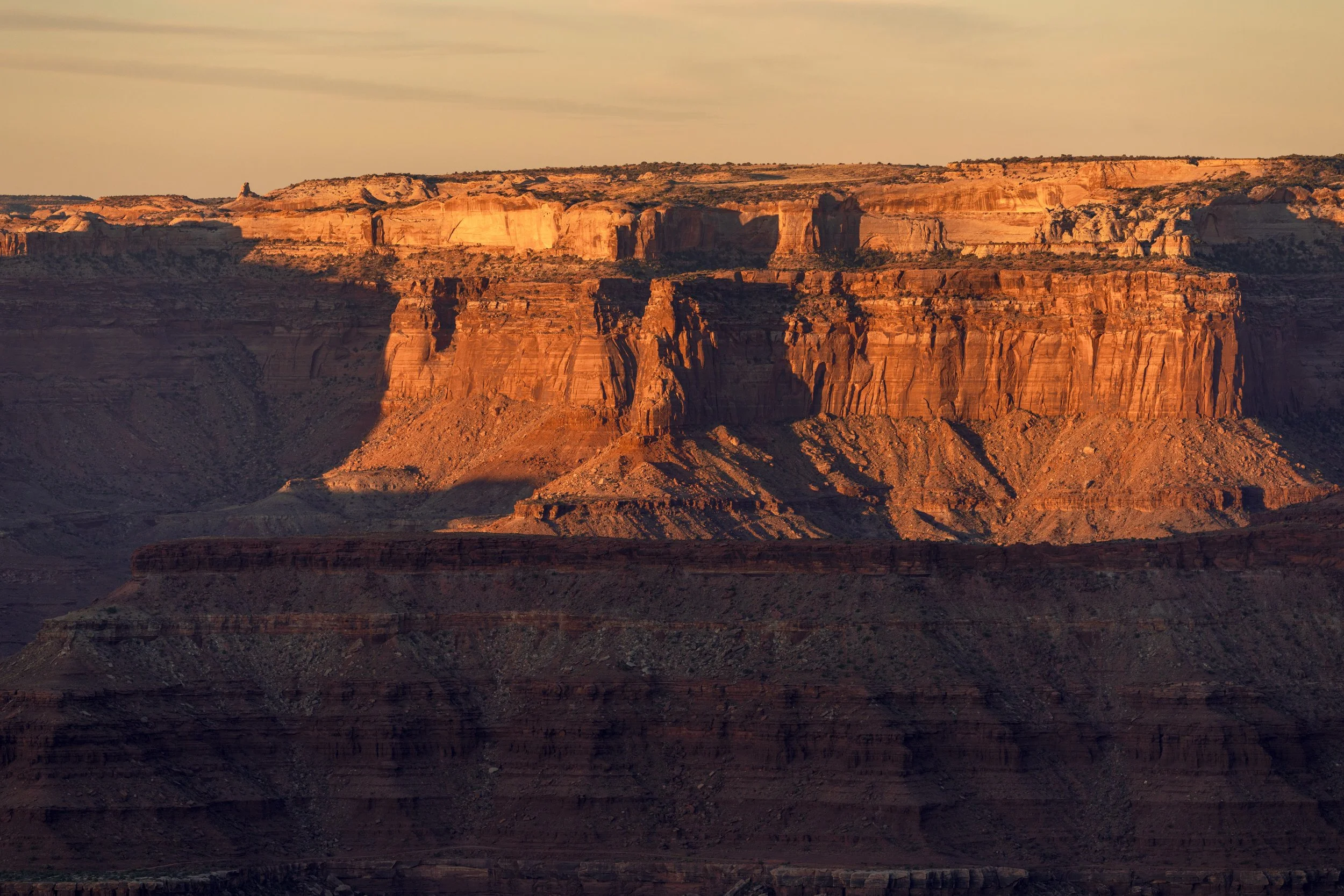
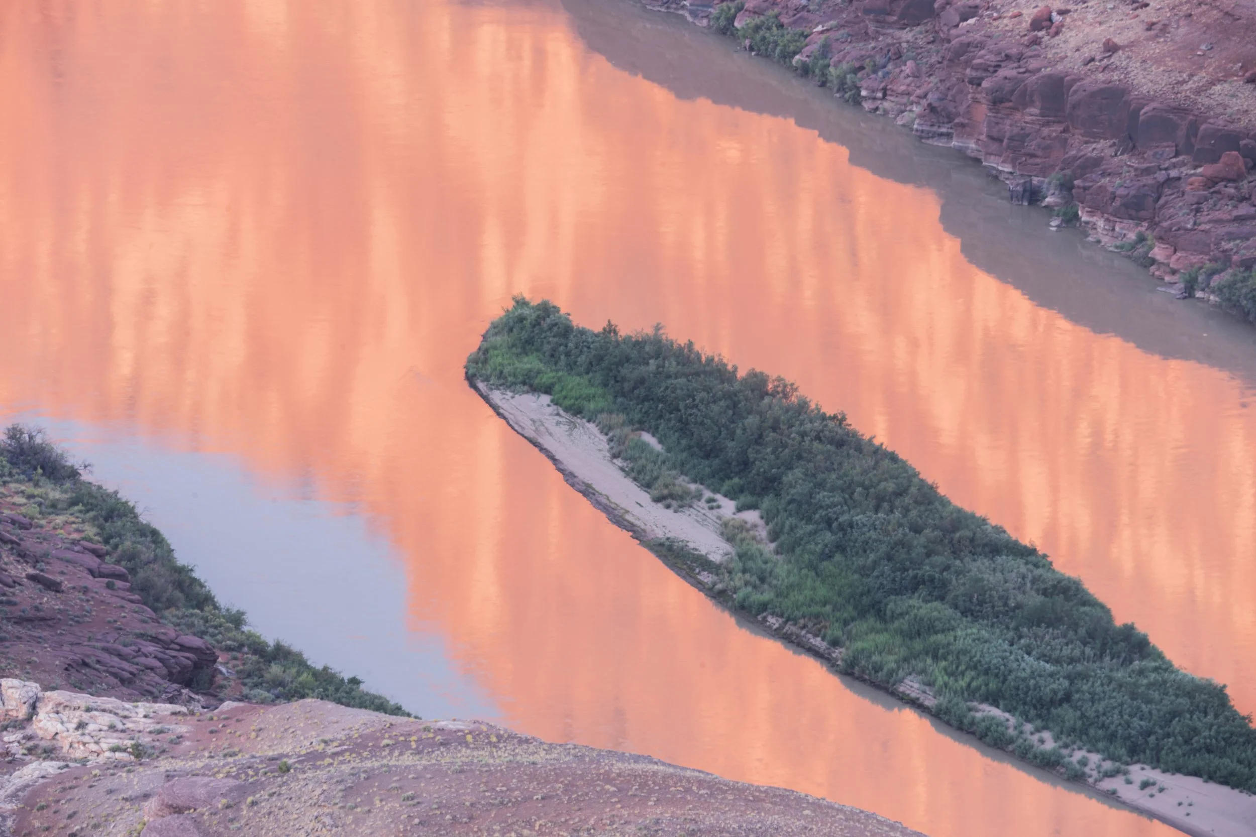
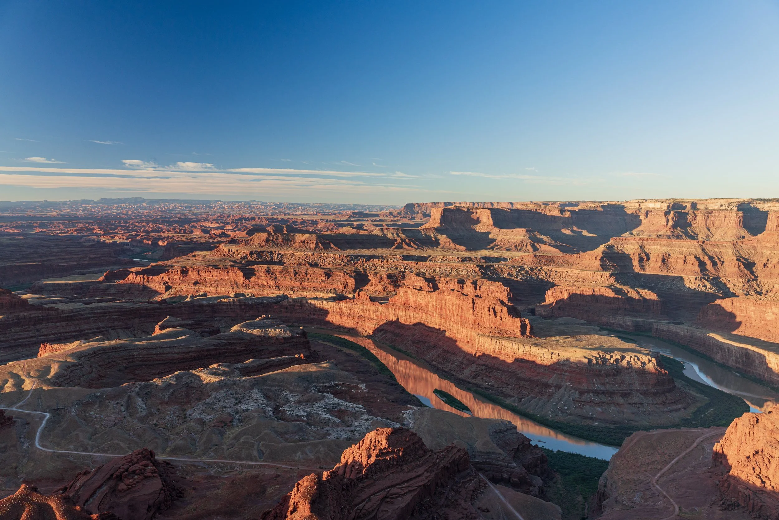
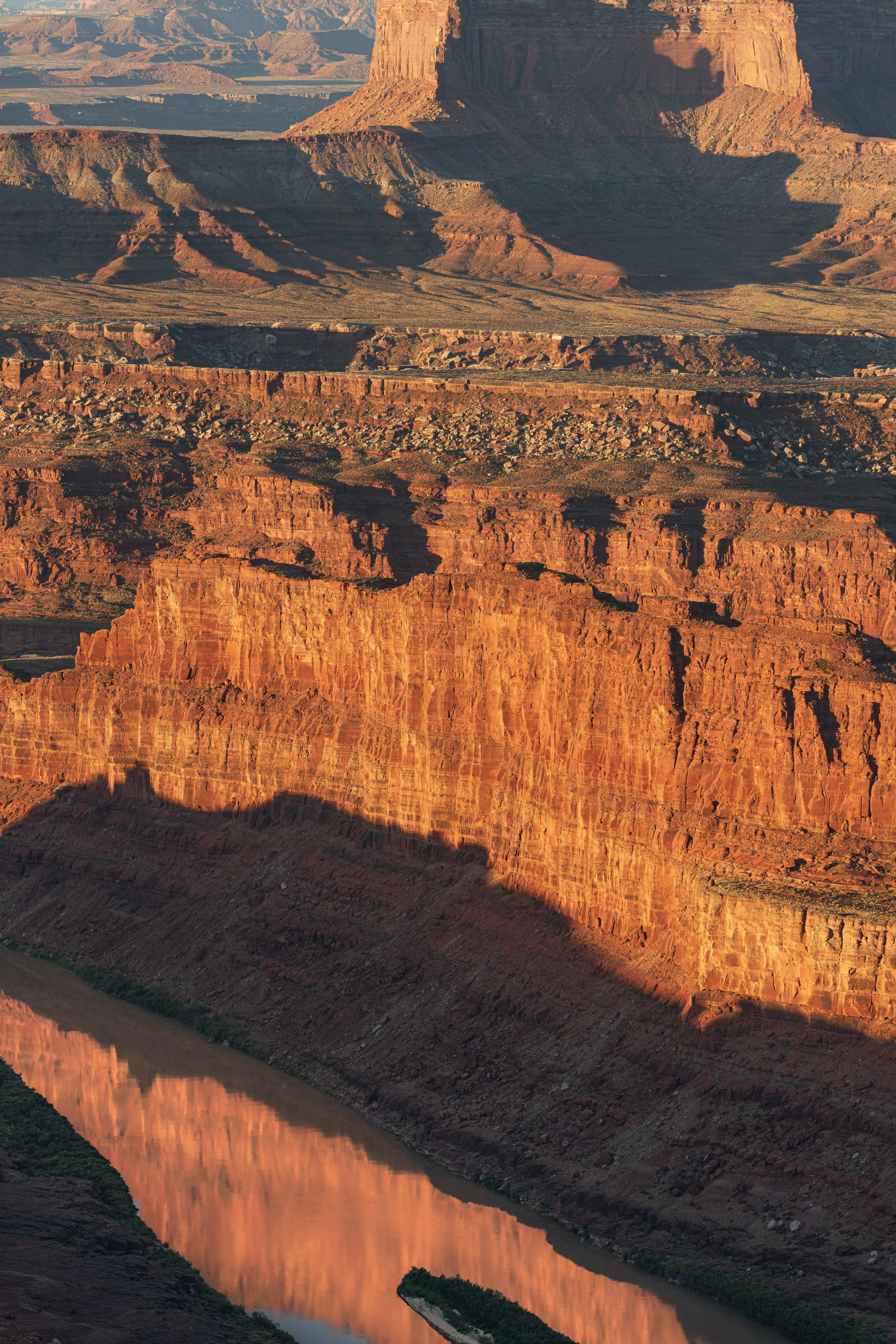
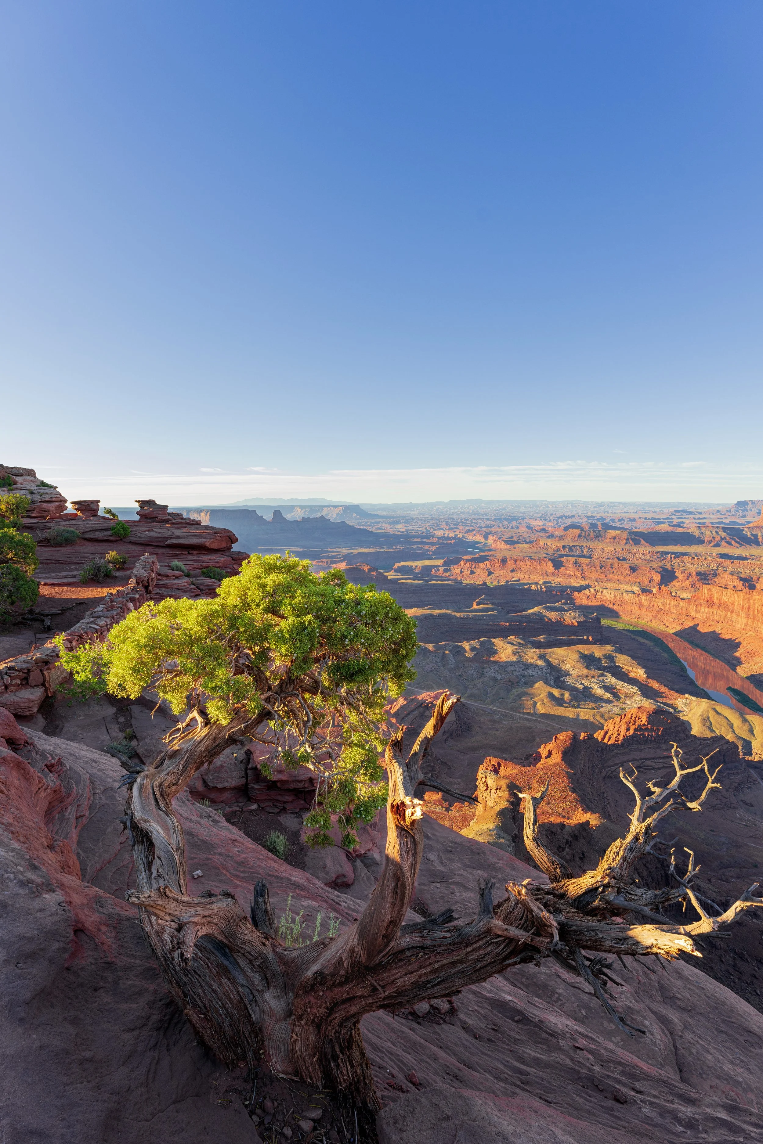
My setting this morning was Dead Horse Point State Park, a quick 15 minute-drive from Lone Mesa, so I had ample time to search for a good place to setup the sunrise. Dead Horse Point State Park is located at the northeastern edge of the Island of the Sky section of Canyonlands National Park. The State Park consists of a few square miles of cliff face overlooking the vast and deep canyon carved by the powerful and majestic Colorado River. This canyon is almost like a baby brother of the Grand Canyon, chiseled out by the same river, each deeply layered with a breathtaking system of rock faces and eroding cliffs, twisting and turning as the river heads southwest towards Mexico and the Pacific Ocean. But unlike the Grand Canyon, almost nobody is aware of this park to experience the beauty of the canyon! In the bright yellow glow of the morning sun, I was virtually alone, and this made it extra special. I found a spot at the edge of the cliff and set up both cameras to capture different angles of the canyon. I wanted to convey the vastness of the landscape, but also how intimate and small each twist and turn can be. I wanted to utilize the sunrise light, which dapples off of the canyon walls in ever-changing patterns, to fill the scene with an incredible depth, contrast, and warmth.
Once the sun rose enough above the distant mountains to bathe the entire canyon floor in new daylight, I finished my shoot. While I felt the pangs of hunger, before eating, I needed to attend to some chores. The large solar generator I rented for the trip to charge all of my camera equipment was running low, so I pulled out the solar panels to take advantage of the clear bright sky. I set up the solar array on the roof of the truck and spent the next hour at the rim of the canyon perched on some large rocks cooking breakfast and writing about the previous days in my trip journal, pausing every few minutes to ogle the abounding scenery. When the generator and my stomach were properly fueled, it was time to pack up and continue along the canyon edge to reach the main section of Canyonlands!

Part 4: Canyonlands NP & Corona Arch
I hoped to harness that momentum gained from the excitement of the Dead Horse sunrise to press on with more wonderful shots in Canyonlands, but reality met me like a wall and I was humbled quickly. Up to this point of the trip, I had been mainly visiting less traveled, off-season areas of Utah, so the crowds were sparse. Crossing the official Canyonlands sign, I soon was greeted with my worst nightmare: a long, long line of cars at the park entrance. I had not considered this contingency during the planning phase of the trip, so the decision to take a little extra time to relax and charge the solar panels at Dead Horse, which seemed harmless, now came back to haunt me. Faced with the prospect of a long wait (I just passed a sign on the side of the road marking the “1 hour to booth” point), I felt pretty stupid for the lack of anticipation. I could only imagine my father telling me it would be best to get to the park straight away to avoid lines! Since I had a full day planned and a backcountry camping permit for a night stay in the park, so I had to be patient and grit my teeth. Thankfully a lot of other line sitters did not share my motivations and bailed, and soon I was rewarded for my patience and entered a new park to explore!
Canyonlands National Park is large and consists of three distinct sections, totaling more than 330,000 acres. Each section is separated by the confluence of the Colorado and Green rivers which merge into the even larger, lower Colorado River. Even though this park is stunning and massive, it does not draw the largest crowds (which is why I was surprised by the line!). Approximately 750,000 people visit per year, and those come mostly due to the inaccessibility of the other, more popular park. Each section has some drive-through proportions for the everyday tourist, but much of the park is backcountry, rough canyon roads. I was not confident enough to take my rented truck to some of the extremely rugged roads, but I did have a backcountry camping permit, so I could backpack for the night and then get back to the car in the morning. This was my main activity for the day, but first I was keen to drive down the whole of Grand View Point Rd, the main thoroughfare, to see the best overlooks this section had to offer.
First stop was Mesa Arch. While this arch might not immediately stand out like other features in other parks, it happens to be one of the most Instagrammed from any national park. This fact was evident immediately upon completing the short 0.2-mile hike down to the arch, which spans low across the canyon edge with a breathtaking view of the chasm below. I had to wait for over 10 minutes, camera set up on my tripod, before I could even attempt to get a shot with no people in it. Finally, a nice guy who had observed me waiting did what I was too shy to do and yelled out for everybody to give me a few seconds to get my photo.
I was very appreciative of him but the entire exerience left me feeling downcast on the state of our countries enjoyment of our natural wonders. I understand that it is nice to have pictures of yourself with beautiful landscapes, but I think we are degrading the original intent of preserving the parks when treating them like a green screen. And to be clear, I recognize that I was there to take photos, but I was standing well out of the way, taking in the scene and allowing others to join me in watching the scenery, instead of sticking myself selfishly in front of the nature, which is why people claim to be there. John Muir did not fight for decades to protect nature so he could have self portraits painted in front of Redwoods, they are a place to remove ourself from the center of attention and think about what was here before us. Enough of the philospohical grumbling, my Dad (an editor) strongly recommended I remove it entirely but I think it is an important conversation to have around our natural resources and I refuse to leave out what I feel so strongly about.
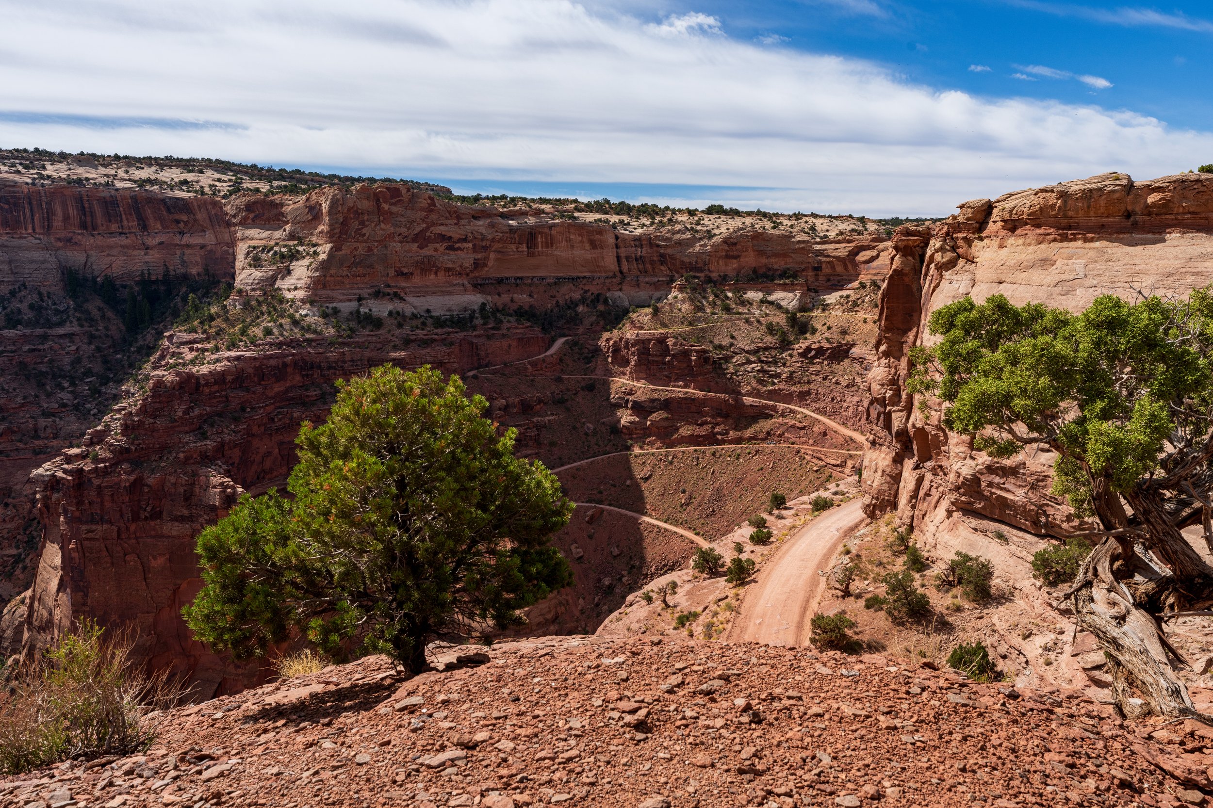
Leaving Mesa Arch and the crowd, I stopped at Grand View Overlook, a massive 180-degree open view of the river confluence and canyon systems below. Having hit the highlights of the Island of the Sky section of Canyonlands, I headed back to the syncline loop trailhead where I was going to start my hike later in the day. Not wanting to leave too early in the highest heat of the afternoon, I spent some needed downtime laying out in the truck and mentally preparing for the hike. This hike is rated difficult. To get to the Syncline campsite at the bottom of the canyon one must hike 3.5 miles and descend 1500 feet. With my backpack laden with a tent, sleeping bag/pad, food, camera gear, and over 5 Lbs of water, I was ready to get going. My hike abruptly halted after only 0.3 miles when I remembered that I had forgotten my headlamp in the car which was necessary due to my need to leave tomorrow before dawn. With the false start out of the way, I got to chugging along. The trail began with an uphill section before shifting towards the first steep descent. When I reached the start of the downhill switchbacks, it was a truly intimidating site. The trail seemed to fall away into the depth of the canyon, and suddenly the hike felt much more daunting. I soldiered on and followed the rocky switchbacks with mounting anxiety and draining confidence. Unexpectedly, I reached a bottleneck where the cliff narrowed and I was staring down at an even steeper, technically more challenging final descent to the canyon floor. I paused here and checked my trusty Gia GPS app which has guided me on past backpacking trips. I was on the right course, but now I realized that this final climb down would be hard enough for my level of experience, but the ascent in the dark of the morning would be nearly impossible. If I were to stick to plan, I needed to rise early and make haste back to the car in order to reach a cool arch on the way to Moab to capture the sunrise. I was also reminded of the time my brother and I had to leave my father under a cactus because our hike turned out to be too difficult. At least we were there to get to the car and retrieve more water to get him out. Who would help me should I fall or otherwise get injured? I knew it would be best to cut my losses and return to the car while it was light and I still had energy. As I trudged back up the trail my body deteriorated quickly and soon I was taking regular breaks, a headache settling in my frontal lobe, probably from dehydration and sun exposure, and panic creeping up to join the party. But despite the inner turmoil, I dug in and found another gear. Like Sam Gamgee carrying a limp Frodo up the side of Mount Doom, I surged ahead and attacked the switchbacks with a renewed gusto. Soon, I conquered the ascent and found comfort in the Ram.
As I recalibrated and figured out a new plan for the evening, disappointment and a sense of failure welled in me. This hike was supposed to be a real test of my ability to handle backpacking alone and I had not been able to finish it. I was frustrated with myself, but as I sat in the car getting ready to drive out of Canyonlands, I realized I made a good decision this time. This trip is first and foremost a photography adventure; the hiking was just a bonus to get to cool places and add an extra element of excitement. Had this trip been about that hike or getting somewhere via that trail, I think I would have been much more willing to complete it. And my disappointment in not finishing it pales to how devastated I woud’ve been if I missed sunrise the following morning at the new location. Overall, this was a good lesson for me, a cautionary tale, and not a portent of future failures, leaving the boundaries of the park I was determined not to let this keep me from future hiking challenges. Being paralyzed by the fear of failure leads to a lack of important life lessons, there is always value in failure. My lesson for the day: know when it is too much, and focus on the priorities.
My immediate next challenge was figuring out where to sleep, and needing internet I descended into the winding canyon road to Moab for the first time. Picking out somewhere local and healthy, Moab Pizza Company, I quickly attacked some greasy fast food; a deviation from my camping schedule that both boosted my spirits and my connectivity. As luck would have it, there was an NPS campsite just outside Moab which had open, reservable campsites. Still mulling over the day with mixed emotions I arrived around in the darkening twilight. Pulling up to my dusty flat piece of government land the wind was whipping, increasing my fatigue and desire to curl up in my down sleeping bag. I was determined to ruminate only for the rest of the night on the day’s events and then to turn over a new leaf in the morning and focus on what I was here to do.
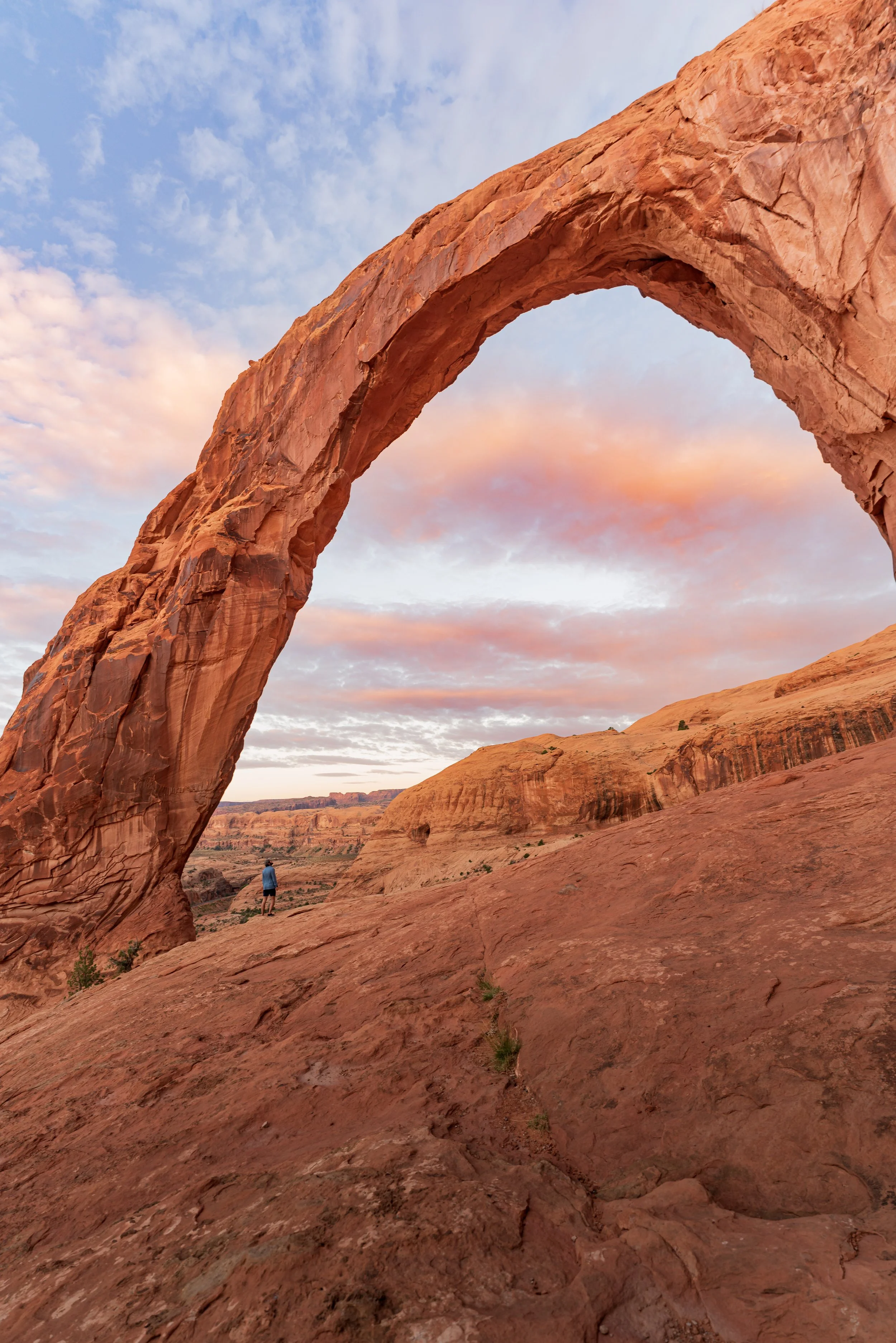
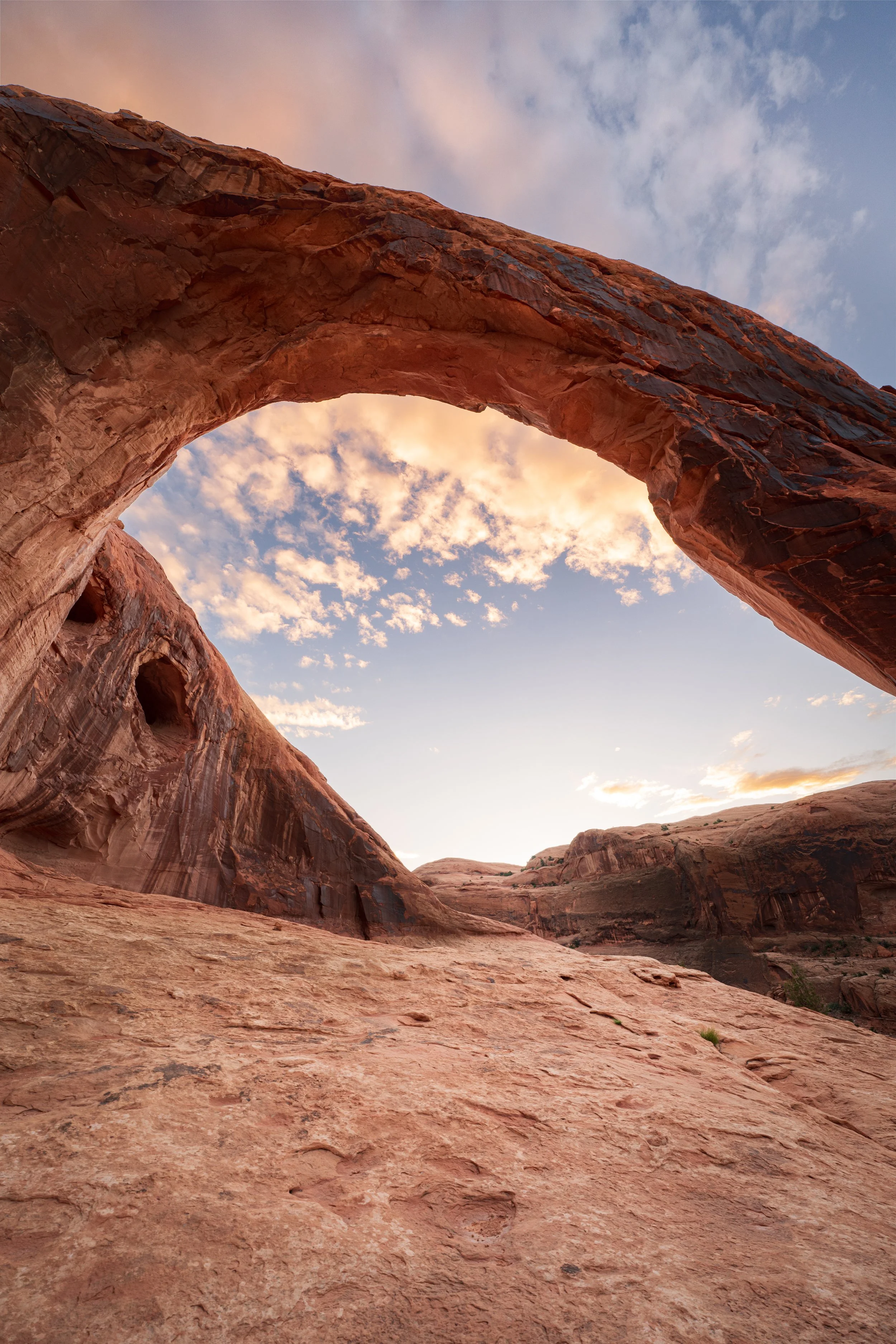
Thursday morning rushed up to meet me in the pre-dawn hours. I fired up the engine and plotted a course just outside northwestern Moab onto a small dirt road where the town meets the Colorado River. From there, I drove west along the river until I reached a small pull -off below a steep jutting cliff wall casting black shadows upon the empty parking spaces. My destination, Corona Arch Trailhead, is not inside any National or State parkland and is accessible only via a one-mile, relatively easy trail that climbs up into a small pass in the plateau. I was able to get to the arch quickly using the headlamp until the sky lightened enough to see without it. I traversed the sides of the rocky face, across an old rail-road track following rock cairns, and eventually using the arch itself to guide me. Corona Arch is a partial circle arch that protrudes out from the rock wall like a horseshoe or door handle, or like the corona around the sun during an eclipse, thus its name. Seeing the arch softened my mood immediately. I had not anticipated I would be the first and only person viewing the arch and felt very ecstatic that I was able to get pictures and videos of the arch undisturbed. Even better was being outside of government lands, which allows me to fly my drone and get sweeping panoramic views of the arch in a way that is rare with such natural wonders generally falling inside the parks. My DJI Air 3 flew effortlessly around the canyon capturing as many angles as I could hope for including right through and above the arch!
The sunrise was not as dramatic as others owing to a perfectly clear sky, but my photos were acceptable. With nobody else there with me initially I could put myself in the foreground with camera 40-50 feet away to get a great perspective of scale. And when sunrise brought travelers I sat back and experimented with focus stacking images with cactuses right next to the lens with the Arch in the background. The large group of German tourists and more in the distance marked time for me to split. I shared my hiked back to the car with a friendly retiree who spends most of the year traveling the country with her two dogs. The opportunity to talk to a like-minded wandering spirit was nice, and on this brief hike, we exchanged travel stories and some local recommendations before parting to seek new experiences on different yet parallel adventures. I was doing well on time and decided to spend the day in Moab and use the time to acquire souvenirs for my girlfriend and family.
Shopping is not my thing, so I relished hopping back into the Ram and making for the other section of Canyonlands National Park, The Needles. The Needles is only a few miles across the Colorado River (as the crow flies) from Island of the Sky where I was yesterday but is only accessible by car via an 1.5 hour drive south east of Moab to the official park entrance. The large prairie-filled valleys that guide visitors into the park are strikingly beautiful and reminded me of early Hollywood depictions of early settlements in the West. After passing the prairie, I quickly saw the spiky needle-like sandstone rock columns for which the district is named. These form ridges along the desert floor and make endless unique shapes and patterns. Unfortunately, I was limited to traveling the small main road, which had few (but cool) overlooks. To access the rest of the park requires backcountry hiking or drives on rough 4X4 roads. Paradoxically, I was heartened to see this section was not completely spoiled with easy-to-access tourist runways and crowded parking lots, but I was disappointed I did not have the time nor the confidence in my ability to criss-cross the area’s rugged terrain in the rented Ram so many of the wonders that lay hidden beyond the needle s will remain mysterious imaginations until I can return.
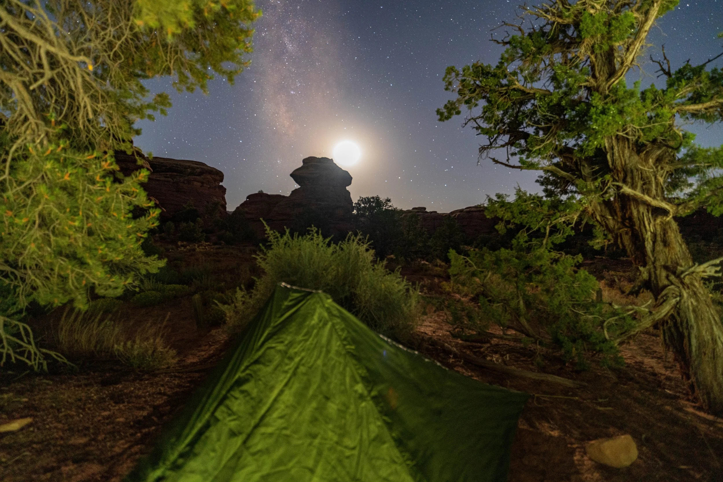
Instead, I headed straight to my second chance at backcountry camping. This would be my last wild camping of the trip, and a lot less challenging so it was not optional! At the terminus of the main 4X4 route into the Needles backcountry (Elephant Hill RD.), there is also the start of a trail that leads backpackers to a scattering of backcountry campsites hiding among the rock spines. These are reservable via permit through NPS. I secured the first campsite on this route which meant that I only needed to hike less than a mile on a relatively flat desert tract to reach my nighttime haven. Although the hike was not challenging, the scenery was spectacular. The trail lead me around large rocks and among shapely pillars. I felt encapsulated by absolute silence as I heard not one bird, plane, or human, just the sound of my hiking poles tapping the sand and the low desert shrubbery brushing my boots. As I was settling my normal hiking groove, it was over. I extricated my lightweight trekking pole tent and quickly pitched my home at BS1 campground, which partially rested under a canopy of small desert trees offering some relief from the scorching desert sun. I spent the rest of the evening cooking my meal, writing in my journal, and staring into the wilderness, enjoying the tranquility. Contrary to my imagined experience I did not explore or even look for a place to take sunset pictures. Due to the bowl-like valley I was in, any view of the setting sun was blocked, and the sky was devoid of clouds to provide any enhancement to the light. Before going to bed I set up a Milky Way timelapse with my tent in the foreground instead of picking out a more natural composition. I still felt slightly uneasy about being truly isolated. The sheer emptiness of this park and my shell-shocked nerves from the previous night kept my rooted to my perceived haven. As the sky darkened and night descended the Milky Way above was my only friend as I slipped into a restless sleep.
The next morning I timed my hike back to the car perfectly for the sunrise and was treated to a peaceful and beautiful show of soft light shimmering off the needles. I used the moment for silent contemplation and appreciation of the trip so far. I felt somewhat redeemed from my failures at the Syncline loop, even though this hike was not long or strenuous. I overcame the unease caused by my isolation and as a result, felt stronger for it. As I brushed my teeth in the parking lot looking out at the rising sun, I drank in my final impression of Canyonlands and prepared for the last chapter of my adventure.

Part 5: Warner Lake & Arches National Park
Leaving Canyonlands on Friday morning was bittersweet. Driving back past the welcome sign, I had completed ⅔ of my trip and only had two more nights left in Utah. I made my way back across the open, rocky prairie, which divides the bluffs of the Canyonlands borders and the Manti-La Sal National Forest & La Sal mountain range. The La Sal range is home to Mt. Peale, the 2nd tallest peak in Utah, and the highest point in the state which lies outside the towering Uinta Range. The high passes of the La Sal Mountains were my eventual destination, where I had reserved a site in a campground next to a tarn named Warner Lake. I was excited about this campground because up high in the La Sal range protected by the height and remoteness there are stands of aspens, and a conglomerate of them surround Warner Lake and the campground. My hope, as it was getting closer to October, there might be some beautiful fall foliage color to photograph. As I pondered the Aspens while driving away from Canyonlands, I knew I would be remiss if I didn't return once more to the quaint town of Moab before the busy last leg of the journey. I parked on a side street and went to Jailhouse Diner where I enjoyed a coffee, breakfast burrito, and some toast. This nice hot meal cooked by someone else spoiled me after days of bare essentials living. Back on the street, I strolled through the main shopping area finding last-minute souvenirs I wanted to get for people.
By 11:30 a.m. I was ready to escape and head up into the mountains. To get to the campsite I needed to drive north of Moab to RT 128, which winds its way along the banks of the upper Colorado River until it eventually links up with Highway 70 which serves as a main artery to and from Colorado. I was only on 70 for a short period, looking for the offshoot which was to take me into a small enclosed valley, bordered on three sides by high cliffs or mountains and the far south end is the base of the La Sal mountain climb. I saw a pull-off to the river which was already filled with parked cars, their owners enjoying a small sandy river beach. I jerked a hasty U-turn and deviated from my course to the beach. I was excited to walk down to the sand and dip my feet in the Colorado River. It was extremely cold but pleasant. I lay down on the bank to enjoy the early afternoon sun.
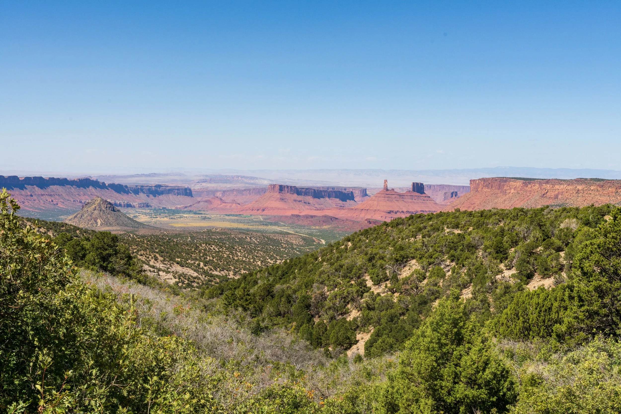
Back on course I quickly found Castle Valley, named after a large rock formation in the middle of the valley with turret-like rocks giving it a castle shape. Then I pressed the accelerator to climb back into the mountains for the third time this trip. The ecosystem of the desert floor transformed into a verdant green mountain forest. The rapid elevation change was noticeable and soon my ears were popping as I summited mountain passes on the narrow, guard-rail free, but well-paved road which threatened an abrupt end to my journey at each turn. The grand views of the entire Canyonlands/Moab/Arches region during the drive was breathtaking. Another highlight was a chance encounter. After many miles of windy roads in the higher slopes of the mountain, I turned a corner, right in front of me, occupying the entire road, was a herd of cows! The local ranchers were driving their cattle to another part of the mountain, and three cowboys rode horses, lassos in hand, wrangling the massive herd down the road. I crept behind, chuckling at the absurd scene, and wondering if I would have to be rear guard for the cows the whole way. Finally, one of the cowboys yelled out that if I kept moving slowly the cows would part in front of the car. So I cut a tentative path through the disgruntled herd and was back on my way.
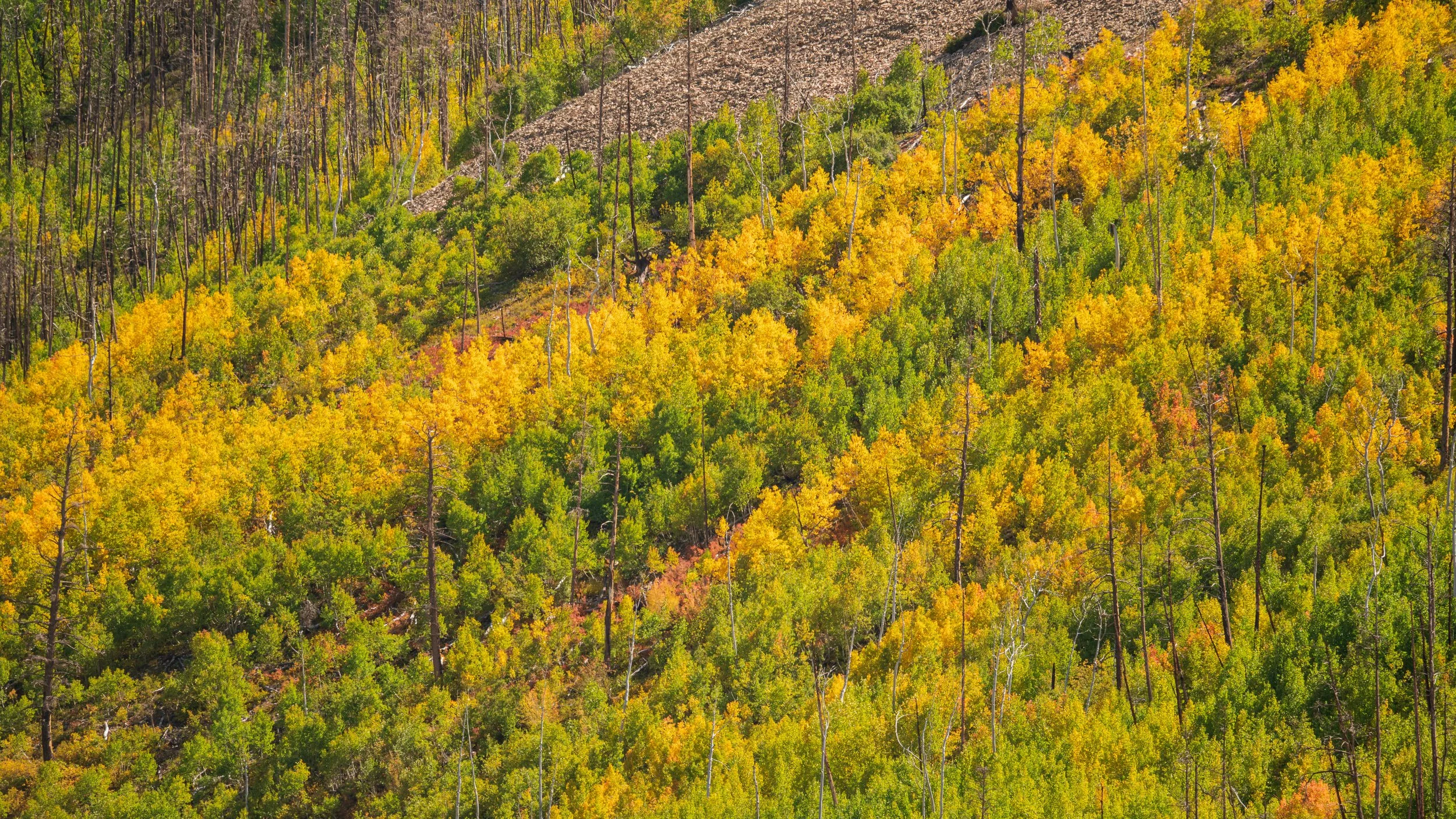
Reaching Warner Lake Campground felt like a few milestones. First, with an altitude of over 10,000 feet, the highest point on my trip, it was truly an alpine experience. Also, I was now only about 12 miles from Western Colorado, the farthest East I would sojourn. It was cool to reflect how only seven days ago, I was only 4 miles east of Nevada in North Western Utah at the salt flats and now I was on top of a mountain almost in Colorado! How cool that Utah contains a vast array of climates and ecosystems that can present unique and interesting challenges no matter where you are. Back at the campsite, I set up my tent and headed out to explore the lake area. The campsite was host to a dozen or so parties of people, but it was almost as silent as the Needles, and I greatly appreciated the respect everyone had for the serene camping experience. I walked to the lake with my camera and camping chair. The lake resembles more of a small pond, but it was still beautiful, with some of the best scenery I could ask for. I sat on the bank reading, watching the trees, and dozing off for around an hour before venturing farther into the Aspen forest to try to create interesting compositions of the chaotic forest scene. My hope for a full fall foliage experience was dashed when I saw I was about a week early. Still, on the high slopes of Mt Waas, I received a small taste with many of the Aspens in the green-yellow transition stage. These were beautiful in their own right, and I cherished the experience.
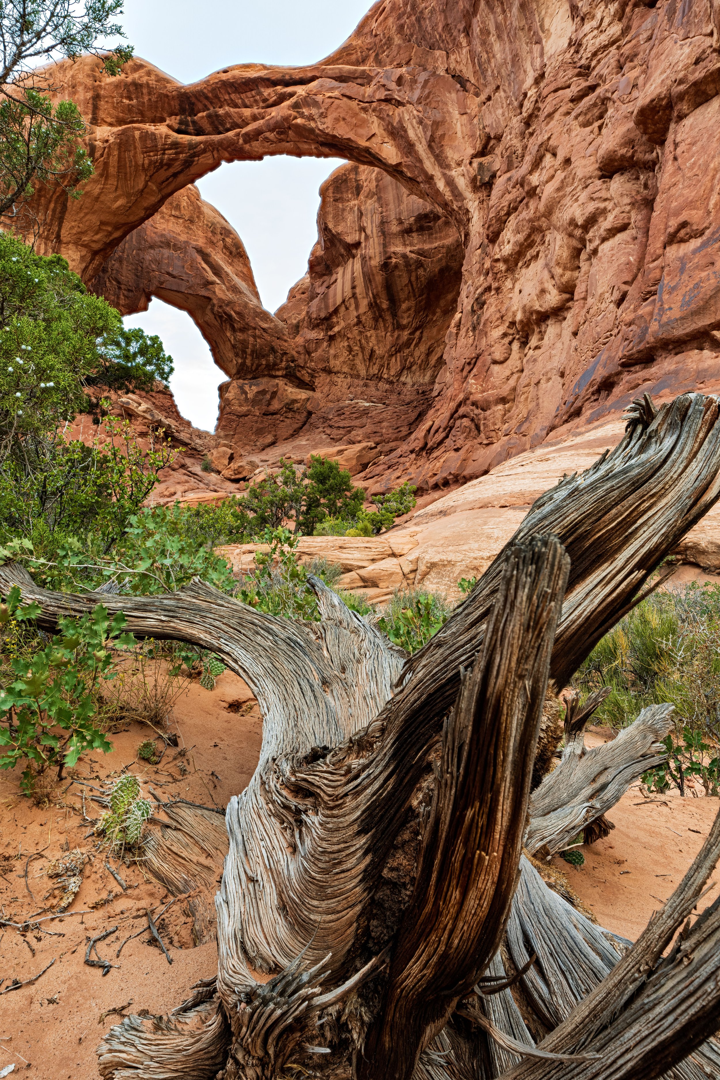
The next morning I woke up extremely early. Besides the default motivation to catch the sunrise, I had learned from another adventurer earlier in the trip that Arches operates on a daily pass system reserved in advance. I was not aware of it before trip so I did not have a reservation, but there were two options for me. First, I could try to get a “day before pass" that is released 24 hours before a visit. The more risky option for the adventurous, like me, is a loophole in the system that if you arrive before 6 a.m., you do not need a pass and can just drive through the gate! So I was up by 4:30am, hastily packing away my camping baggage train in the chilly mist of the morning, removing food from the bear box, and creeping around my site out of respect for the other campers. I descended the mountain passing and sleepy valleys with the efficiency afforded to someone who spent the past day getting lost on those slopes. I rolled up to arches before 6 a.m. and drove right into the park heading to my sunrise location unimpeded! My choice of location for this morning was a unique structure called Double Arch, which like the name implies is two separate archways which are semi attached via the same high ledge they cling to 100-feet above the sandy desert floor. I was hoping to utilize the interesting viewing angle up through both arches into the windows of sky above for the colorful new light of day. The location lived up to the hype as it was an extremely interesting arch but the sunrise was underwhelming. It was hard to be too upset by this though because I was very excited to see Arches National Park and that curiosity overrode and dissapointment.
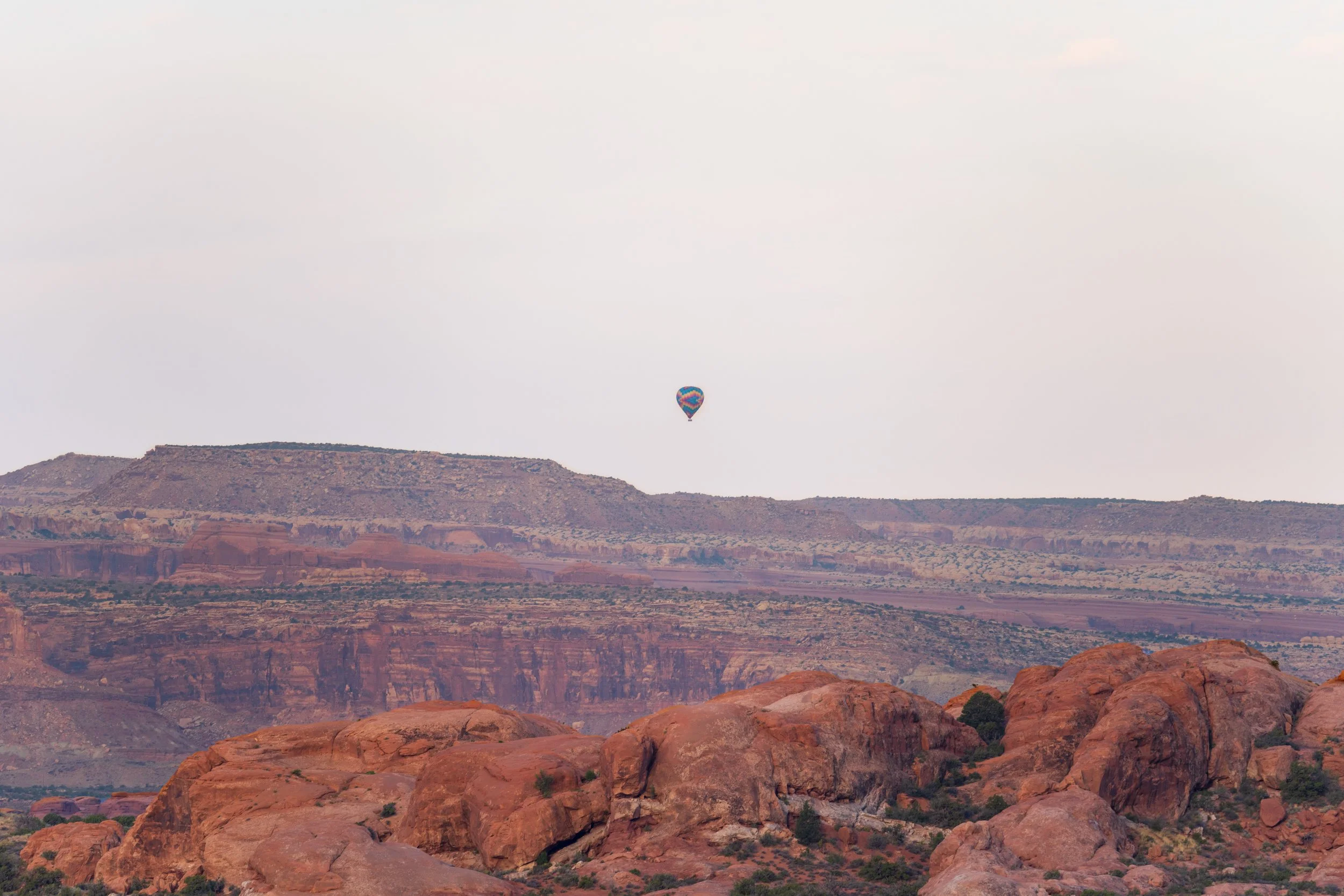
Arches is one of the most visited parks in the entire system, with 1.4 Million people enjoying it in 2022. It is not a very large park, only about 100 square miles, roughly the size of queens in NYC. The landscape compensates for its compactness with over 2,000 natural sandstone arches scattered around the high sandstone plateau. I only had one day to experience as much of the park as I could, so I had no time to lose. After rushing into the park for sunrise I remembered I needed breakfast and decided to return to visitor center at park entrance to cook and replenish my water. Soon I was back properly setting out to traverse the central road that passes all the major attractions. I thoroughly enjoyed the uniqueness which surrounds and engulfs you as you get deeper into this unique landscape. Each arch is slightly different and rock spires and high brilliantly red rock walls abound, structurally it is a stunning park.
After stopping at a few pullofs to see various arches I was struck by a recurring feeling of sadness and confusion surrounding the concept of growing accessibility of nature. I love national parks and believe that greater access to the public natural wonders is essential for connecting people to the earth that they call home. This is especially pertinent in a world where most of us are confined daily to exclusively human habitats. However, it is hard to reconcile this while 5 gigantic buses unload hundreds of tourists 500 feet away from each arch so that they can consume the nature for 5 minutes before being shepherded off to the next photo spot. I am not saying this to disparage everyday tourists of national parks, I have been those people, and I am like them in this moment, but part of my journey through Utah has been trying to connect more deeply with nature. At what point does accessibility to our last bastion of wilderness and adventure cross from beneficial access to disservice to the spirit of nature. We have striven for greater efficiency and optimization of our surroundings for thousands of years, and that is a good thing, but now that we have terraformed so much of the world that we inherited into something that we have built, when is it too much. I don’t claim to have a solution but my gut tells me we have lost our way. When the parks were being established there was a great debate amongst the men in charge of the natural resources at the time, “preservation vs conservation”. Conservation, focus on the proper use of natural resources, such as “limited vehicle access” and sustainable resource collection ultimately won out. This philosophy has worked to conserve and protect what wilderness remained once we woke up to the necessity of untouched earth, but I do fear we are teetering on the edge of abandoning the spirit of the movement in favor of easy enjoyment. A lot of mesaures started in the infancy of our country to tackle a growing population are lacking context of just how great and technological that populous would grow. Just because something is done in order to make consumption easier does not make it better.
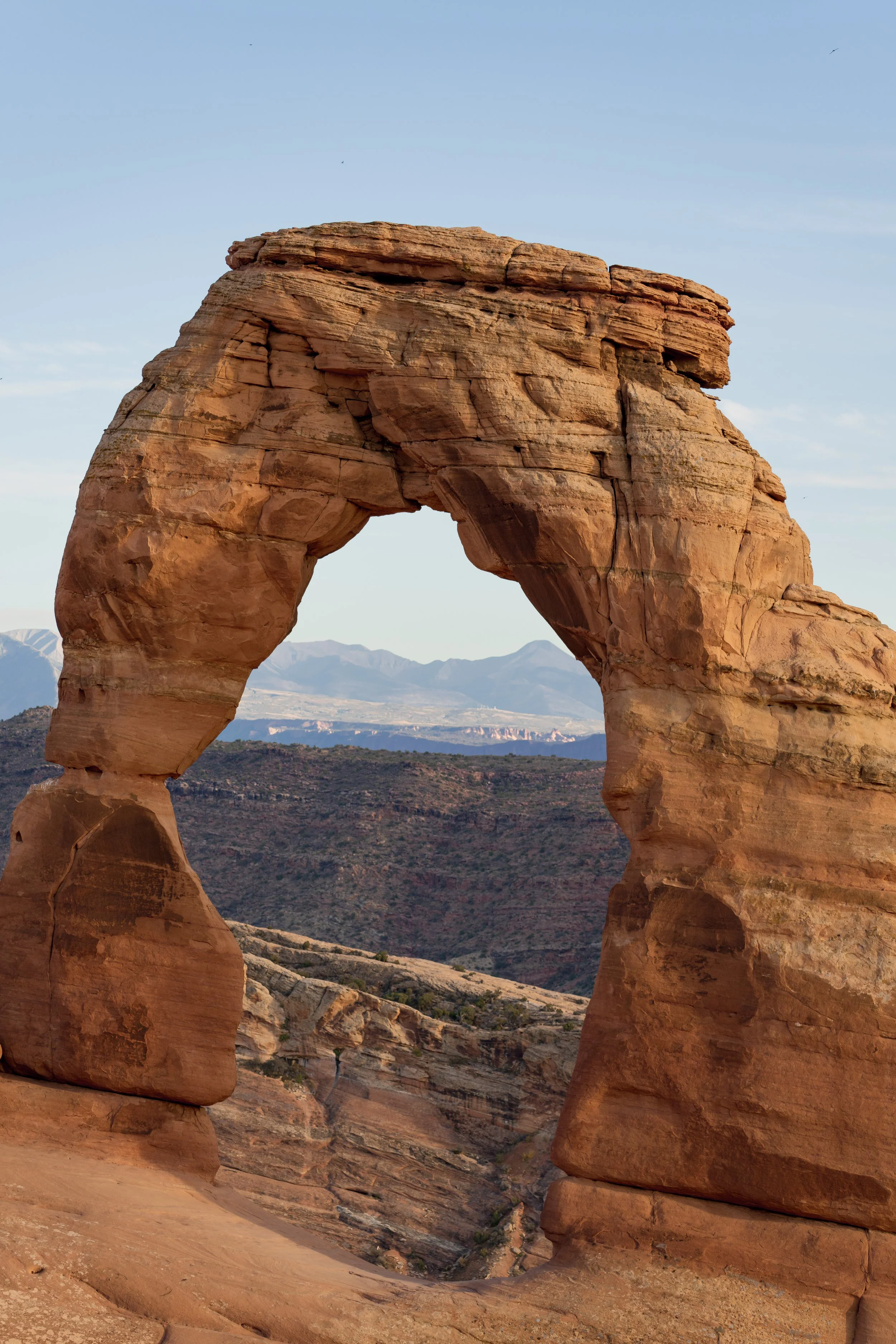
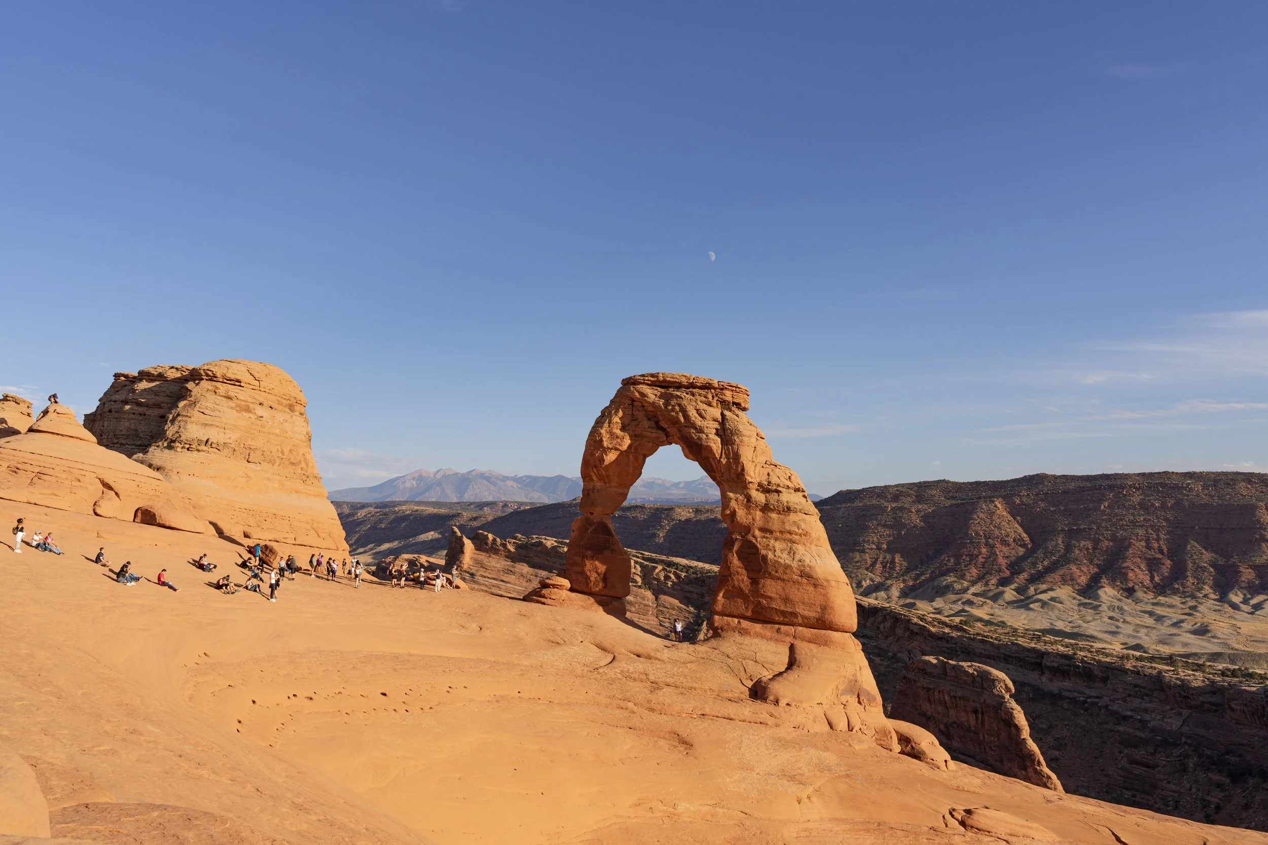
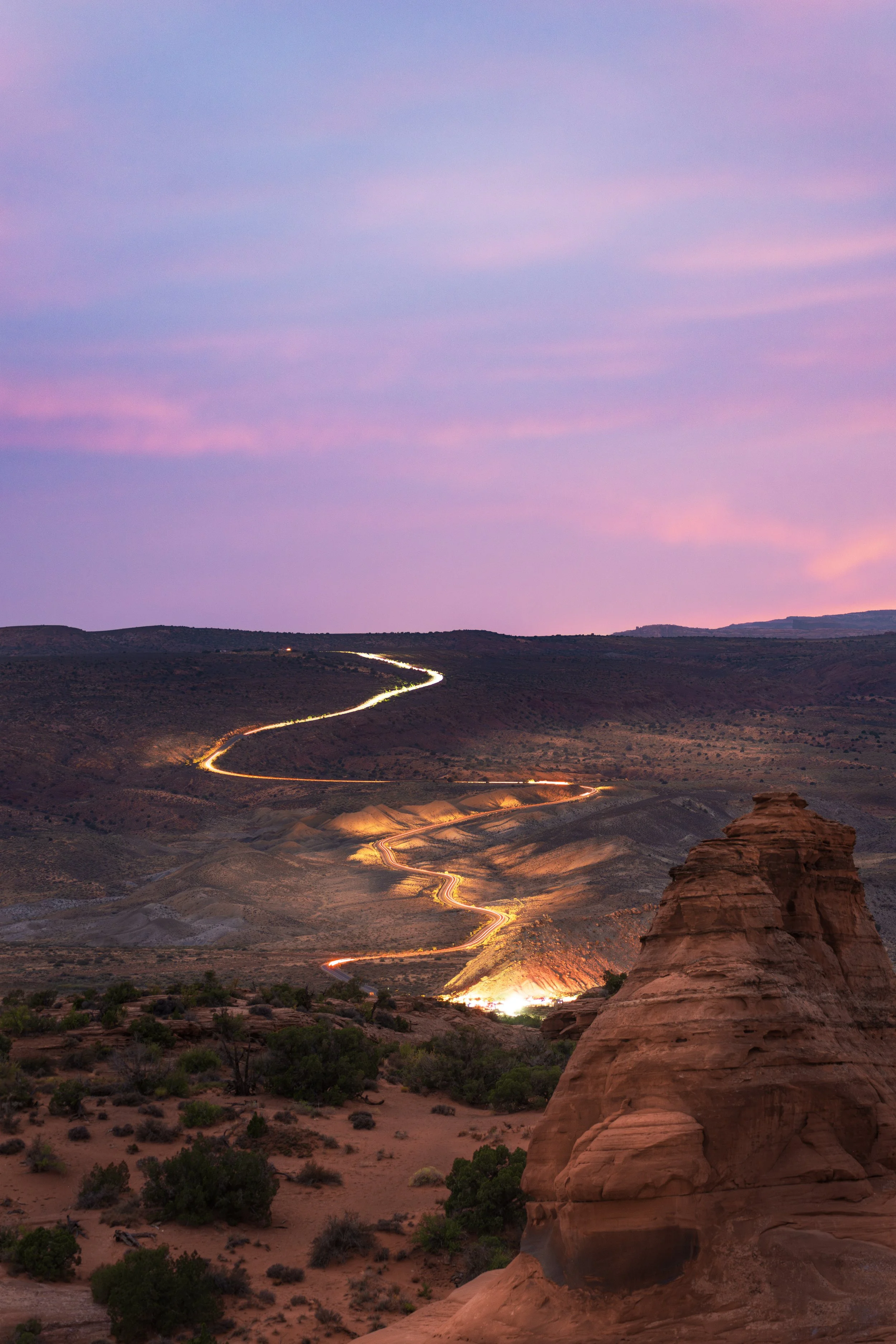
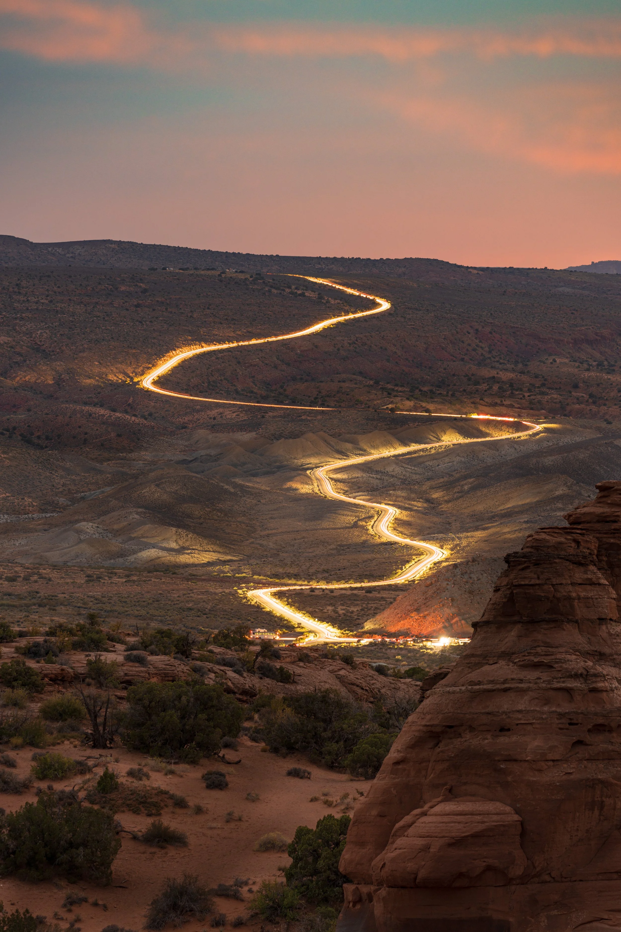
But this musing is just part of a constant battle in my head about our changing world, when my eyes eventually unglaze and focus I was approaching the end of the main road in arches with one last important goal for the trip, my last sunset composition. I was ready to hike up to the most famous and well-recognized arch in the entire park, and maybe the whole country: Delicate Arch. I waited to start until 45 minutes before sunset, hoping that by this time the crowd would have thinned, but as I rushed up the steep smooth rock trail to the arch, it seemed viewing it at sunset was a popular idea. Undeterred, I emptied the last stores of energy my 3 hours of sleep could muster and half ran up the trail so I could beat the setting sun. As I crested the first rise, the trail rounded a narrowly carved outer rock walkway, barely enough room for walkers in both directions to squeeze by and abruptly opened into a sharp basin, and at the other end of the bowl was the Delicate Arch. I wasted no time, setting up my camera and settling into a good vantage point. While there were no less than 100 people lining up to get their own pictures in front of the arch, giving me flashbacks of Mesa Arch a few days ago, I was not as concerned due to the position of the arch which is poised on the farthest precipice allowing for less obstruction by the social media enthusiasts. A few minutes after I arrived I met another traveling photographer, and we became fast friends discussing our travel and photography tales. It was nice to meet a peer who was also concerned about what shutter speed they were using and knew about tripods and lenses. Talking to someone focused on the beauty of the arch itself rather than how they would look standing in front of it was refreshing. As we sat patiently waiting for quick opportunities for photos the sun moved into position and the light became a pretty hue of pink/purple. The arch itself was not being bathed in the soft sunlight but the surrounding area providing the color. A third photographer arrived, also hoping to shoot the sunset. My new friend and I adopted him and the three of us talked and shot well after dark. This conference of random traveling photographers at Delicate Arch was special to me and was a great way end the trip. I like to shoot solo, to get really into my creativity, unbridled by others. But every once and a while, it is nice to share the experience with somebody as passionate as I am. We shot long exposures of the cars snaking up the road away from the hiking area. The headlights/tail lights left long LED snakes on the road well after they were already far away. Then, shrouded in complete darkness, one of us went out to the arch and shined some lights on the underside setting up some cool night shots. I had planned to stay at Delicate Arch to capture shots of my favorite subject, the Milky Way, but the night shepherded in a bank of clouds that were not going to clear, so I reluctantly said goodbye to the arch and my new friends, and just like that my photography adventure was at an end!
After I left Delicate Arch the adventure was over. I struggled to get back to Salt Lake City in the dead of night with my body running on fumes. After a full week of hard sleep and a lot of adrenaline and fun, I could barely stay awake on the road. I stopped for a three hour “nap” at 1 a.m. in an egregiously bright Walmart parking lot halfway between Moab and Salt Lake. I had to reach the airport by about 10:30 a.m. for a 12:30 p.m. flight and still needed to get a wash for the Ram, pack my bags, return the generator, then the car before ubering to the airport. Fortunately, I managed to stay awake following the nap and accomplished all my tasks on time. Eventually I was up in the air and heading home.
After taking time to fully reflect on the experience, I can honestly say that this trip was everything that I had hoped for and more. Let's start with the photography. For the most part, my original plans put me in optimal situations to capture great shots, and the few times I had to call an audible and relocate, the results were serendipitous. I came home with over 900 GB’s of photos and videos, which is a trip record for me! Besides the large quantity of raw data, I found a greater number of my compositions were of really nice quality. I can attribute some of this success to traveling alone, allowing me to go wherever I thought would yield the best photos, at the best times of day. The latter really does makes the difference between good photos and great ones, and that was a huge revelation for me on the trip. I had always listened to others preach this concept, but getting to experience so many golden hours in a short span of time really taught me that soft light can unlock another dimension within interesting scenes.
Then there was that question I kept to myself: ‘How would I fare completely alone for a week in challenging and tiring situations?’ I think the takeaway for me was that I really liked it. Getting to slow down and dive into my own thoughts the entire time and focus on my work and feelings was really cool. I am not saying that I want to do this kind of trip all the time, but I feel more confident that I can spend long periods of time alone and come away with a positive experience. I think after the backcountry hiking situation when extremely potent fear and anxiety due to the difficulty of the hike and then the lingering sense of absolute isolation overwhelmed me, is something I did not expect and will need to reflect on more. I think it is something that can ultimately be conquered with more experience and proper planning and time.
This was a keystone trip in my development as a photographer and as a person, and I would encourage anybody who is a travel enthusiast to give solo traveling a try. Truly focusing on what is important to you makes a ton of difference! I hope my long winded descriptions and information complements the photography, because no photo is an isolated image. What makes it so special is the journey behind it. The story of life that comes with every experience is what can differentiate a snapshot for Instagram from a piece of art.

